Wow, what an amazing race! We first formed the team and all worried about making the 10 min pace that's required to finish. At end, the team, mostly with the original members (we only had replace one due to injury), and with a couple injuries before and during the race, we finished in 31 hours and 46 minutes, which is 9:09 pace!
This race is so much more than just running. Actually running is not even the hardest part of the race, despite it been the steepest terrain that most of us have ever raced in. It takes an amazing amount of work to organize the gear, water, gatorade, food, driving, sleeping, all the things that 12 people needs for over 30 hours while living out of vans. The fact that we managed to do it without any real conflicts was incredible.
Our fastest runner suffered a partial MCL tear in his right knee the week before the race. This gave us a bunch worries but he convinced us he's gonna run with a knee brace. To our relief he did not make the knee worse and though he did not run as fast as he would liked, he still posted the second fastest time for our team.
The unexpected injury was our team Captain. She had leg 12, 24 and anchoring the race with leg 36. Leg 12 was a long one on the Blue Ridge Parkway and at end of that leg, her left foot was painful, but she kept it to herself. Leg 24 was a short 5k which she cranked out and really aggravated the foot. When she told us about the pain, we were super worried. The pain was around the the 2nd and 3rd metatarsal area and we thought it maybe Morton's Neuroma or stress fracture. She insisted running leg 36 and carried a cell phone with her just in case sometimes happens. We waited anxiously at finish line in Asheville, and to our shock, she came in around 10 min pace! On Monday after the race, she was diagnosed with stress fracture. Tough girl, running all over the mountain with a fractured foot!
I tallied my sleep, and counted about 4 hours total from Thursday morning to Saturday afternoon at end of the race. Needlessly to say, I crashed in the hotel Saturday evening. Still feeling a bit tired from the effort, but hopefully will be ok for Hinson Lake next weekend.
Pictures

Thursday, September 15, 2011

Monday, May 23, 2011
Unfit to ......
Jade taught the introduction to playboating for women class and had five amazing women to share her passion for rotating the kayak in three dimensions. I'm almost kind of envious of her class. Wish mine was as fun.
Jade's class at Ledges putin.

My class had four students. Steve was the most skilled but hard headed, Sonia and Bob are about equal skill and absorbed instructions like sponges, and Chip is just on a whole new level of not fit for paddling. Ok, I get that kayaking can be appealing to people who are not fit, since you do everything sitting down. How hard can sitting down be? Let me show you this video of this kid Dane sitting in his kayak:
Nothing Dane did in this video happened by accident. Kayaking at Dane's level requires super strong core strength, flexibility, not to mention ability to not breath for extend period of time and fearlessness. Chip weighs about 280 lbs and is 5'10. He's out of breath and strength simply from draining water of his kayak and trying to get back in the boat. I can teaching kayaking, but I can't teach fitness. While majority of people are fit enough to benefit from paddling instructions, Chip will benefit far more from losing a few pounds and enroll in some kind of work out program.
I still enjoyed the weekend immensely. I simply wish people will realize there is no magic formula. To be good at kayaking or anything, you have to work hard at it, and that includes working hard at being fit.
Wednesday, May 18, 2011
Art Loeb Trail Run
I have heard of the Art Loeb Trail before, but never paid much attention to it. When Charles first invited me to this run, I found some amazing pictures of the balds atop the Shinning Rock Wilderness area that made me super excited about this opportunity to run the entire trail.
After I injured my right leg during the unsuccessful attempt at 100 miles at Umstead 100, I took two weeks off from running and slowly got back into it during the next four weeks. A week before the Art Loeb Trail run, my longest run was 13 miles which was a huge cause for concern since I was forecasting at least 11 hours for the ALT. On Monday, I decided to see if I can do a little better, and staged a 20 mile run on the Falls Lake Trail from Hwy 98 to my parent’s house off Falls of Neuse Rd. It went successfully, though it took less than 5 hours, and nothing hurts afterward, so it gave me some confidence about ALT.
When Charles send out the list of runners, I recognized about half of them and realized there is a good chance I will be the slowest runner by far and there is a good chance I’ll be running alone for a good part of the run. After been warned about lack of trail markers and confusing trail intersections on the ridge portion of the run, I started preparing my packing list with the intention of be prepared to stay overnight on the ridge if necessary. I worried that my Nathan 2L pack won’t carry enough gear, even though I can carry almost 3L of water by combining it with the Nathan water bottle belt. So I went to the Camelbak 3L hydration pack that I originally bought for mountain biking, and that I have never run with before. It has two very large gear pockets which enabled me to carry the following:
• Map
• Compass
• Camera
• Rain Coat
• Long sleeve shirt
• Leg sleeves
• Hat
• Headlamp
• Knife
• Toilet paper
• First Aid Kit: bandait, duck tape, water purification pills, salt sticks, blister tapes
• Food: three Honey Stinger gels, three Honey Stinger chews, 3 oatmeal cookies, and 2 PBJ sandwiches.
• $20 cash
I was going to carry my phone as well, but when I found out the phone didn’t have signals within a few miles of Camp Daniel Boone, I decided to not carry it. In hindsight, it was a mistake. Damian later told me there are spots on the ridge with enough signals to send text messages. The Camelbak does not have any pockets on the front of the harness, so I added two Nathan pockets to lower webbing harness to have easy access to food, map, and compass.
Jade and I left Raleigh on Thursday morning and paddled the Nantahala River on Thursday and Friday in preparation for teaching the Carolina Canoe Club’s Novice/Intermediate Clinic the following weekend. We arrived at Camp Daniel Boone on Friday afternoon just after Mark and Tom but before anyone else. One by one runners, families and friends arrived and we made some discussions about the trail before going to sleep around 10pm. We end up changing cabins twice after discovering hornet nests in two of them. Finally got to lay down in the bunk bed around 11pm with the alarm set for 3:45am.
Ben planned to have simple breakfast of bagels, PBJ, and OJ for us. I usually eat oatmeal, almonds, crasins and bananas for breakfast with coffee. But since breakfast is provided, I got lazy and didn’t bring my usual food with me. Instead I went with what’s available: Bagel, turkey, OJ, and a can of Mountain Dew for caffeine. A few runners set their alarms at the wrong time so we end up not leaving camp until 5:45 as opposed to the planned 5am departure. Ben, Hayley and Melinda drove the 10 of us to the start of the run at Davidson River Campground. The shuttle route involves hwy 215, Blue Ridge Parkway, and hwy 276. All very scenic but extremely windy roads. My unusual breakfast, plus trying to drink mountain dew, plus riding in a fast car through the mountainous roads, made me extremely nauseas and it was all I could do not to make a mess in Ben’s car.
I also forgot to turn on the GPS earlier, so while people are getting ready with their packs, I was circling the parking lot waiting for the damn piece of crap electronics to get signal. It didn’t work, and I followed the runners into the trail with the stupid thing still searching for satellites. I did look at my watch and it said 7:04am.
Immediately I realized I have a problem. I put some food in one of the Nathan pockets and the camera, map and compass in the other Nathan pocket. These things are designed to be strapped to a 2 inch webbing belt, not the slim one inch webbing harness that Camelbak uses. As soon as I start running, they bounce around like banshees. Couldn’t stand this stupidity, so I moved the camera, compass and map to my short’s pockets instead. Fortunately I was wearing my hiking shorts figuring I will do more hiking with running.
The flat start lasted less than a mile, and we start up a long steep climb. Later I would not call this stuff steep, but perspective changes when one moves from flatlands to mountains. Soon I realized with my ultra heavy pack, my bouncing pockets, and my general lack of fitness, I could not keep up with anyone else without exceeding the effort level that I need to sustain in order to have something left near the end. By mile 2, I was all alone, and to be honest I was fine with it. This means I can focus on maintain my effort level rather than been sucked into keeping up with someone else’s pace. This portion of the trail is very dense with not much of a view. I found the climbs hard, but the descents just as hard and very difficult to run down. Pace is rather slow and not worth mentioning.
I came across a few trail junctions and had no issues finding the correct trail due to excellent trail marking. Around mile 6, I came across one junction and with no good indication of which way to go. Left or right? Right goes up, and left goes down. Left looks bigger, so I took it. After a minute or so, I was surprised to see Mark and Tom coming back. They haven’t seen a trail marker in awhile and decided to check. I came back with them, and together we took the right trail which went straight up, and up, and up, and up….. and finally we climbed to the very peak of the mountain. The view is spectacular, but the Art Loeb Trail is not where we’re. We had just made a 400ft climb detour to the top of Cedar Rock Mountain.

Back down the trail, we did a good job of sticking to the trail and arrived at our first aid station at Glucester Gap at 11:40. By then the three of us are an hour behind the group in front of us, and Mike and Mark decided to drop due to leg issues.
Tom and I refuel and refill, and after a 12 minutes stop, started the climb toward Pilot Mountain. Tom is a far stronger climber than I’m so I told him to go ahead and I’ll catch up on the downhill or when we get confused about trail junctions and he can wait for me and my map. The climb up to Pilot Mountain is absolutely brutal. In just under 2 miles, the trail climbs from 3200ft to 5000ft. It took me just over an hour to make the climb, yes I’m a pathetic climber. The other side of Pilot Mountain is just as steep, to the point of pretty much unrunnable. I made another wrong turn near Deep Gap shelter but fortunately found my way after only 10 minutes. At Farlow Gap, I ran into a couple attempting to make a loop hike armed with a hand drawn map. They were pathetic enough that I stopped and attempted to help them with my big map. Not sure how much I was able to help, and hopefully I don’t hear about search and rescues for a lost couple.
The trail then gradually climbs toward the Blue Ridge Parkway. The grade is not hard but consistent. I see no sign of Tom, and a few hikers that I ran across also did not see him. Finally I arrived at the unmanned Aid Station at 2:36pm. I wolfed down as much pretzel as I could since I had left my Salt Stick zip lock bag at the first aid station by accident, and have been swallowing as much sweat from my face as I could to not get into hyponatremia.
On the north side of the parkway, the ALT literally goes straight up for 500ft in 0.3 miles. It was slippery and wet since the fog has moved in. Once the trail reaches the top of the ridge, it flattens out to nice runnable trail for a mile before reaching a road crossing where Melinda was waiting with her kids in the truck. I checked in with her and pondered whether I should continue or not since it’s already 3:22pm and we had set an unofficial cut off at 3pm. I knew sunset is 8:24pm, which leaves me five hours to complete the last ten miles. Even with a bit of trail finding, I thought I had plenty time to complete the run before sunset. I knew all along that the next 6 miles will be the reward for all the hard work getting here since the trail traverses a 6000ft ridge through the Shinning Rock Wilderness and the scenery up there will be unmatched. I got this far, there is no way I will deny myself the chance to see this portion of the trail.
There are tons of hikers in the first few miles of this section. Quite a few made comments about my Dirty Girl Gaiters. Despite numerous side trails, it was relatively easy to stay on the ALT through Black Balsam. At top of Black Balsam, I could see the entire Shinning Rock Wilderness laid out in front of me, and with a quick compass reading, it was easy to find the set of ridges leading northward toward Cold Mountain. Even Cold Mountain was visible from this far away. I stopped quite a few times taking pictures, no way I come this far without capturing the moments.

Some of the trails are runnable here and some are not, but it was pretty easy going. Around 4pm I reached the summit of Tennent Mountain and set the camera on timers to take a few shots of myself. Come off Tennent Mountain, I was alarmed when the trail led me eastward toward an another set of ridges, all the while I could see another trail in the distance climbing up toward the northbound ridge that I need to go. Not wanting to make a mistake, I turned back and climbed back to the summit of Tennent Mountain and found a plaque confirming where I was, and the map then verified that the trail will eventually turn back from the eastward direction on Ivester Ridge toward then Grassy Cove Top which is where I need to go. Happy that I’m not lost, I took a picture of Looking Glass Rock that’s visible in the distance toward the southeast.


Running down as much as possible on big and small boulders and after an obvious trail junction, I arrived at Ivestor Gap where the Shinning Rock Wilderness starts and the very last trail sign points toward ALT. There are six trails that intersects within a few hundred yards of this spot, so I was super careful about not taking the first two rights, and really paid attention that I followed the contour line that wraps around Grassy Cove Top on the east side. The trail heads east first then wraps around the bald heading north. I kept the compass in my hand the whole time here checking directions. Just over a mile past the trail junction, I came across two backpackers coming toward me. I asked if they knew how far Deep Gap is, and they both looked at each other and said that would be on the Art Loeb Trail, and this is not the Art Loeb Trail. It turns out they had climbed up from Hwy 276 via Grassy Cove Ridge Trail and had hoped to eventually camp along the ALT. Crap! I turned back and ran along the wet and swampy trail looking for anything on my right that remotely looked like a trail. A couple false leads later, I found a well worn but tiny trail not even a hundred yards from the big trail junction that leads to the correct direction. Apparently the ALT is the tiniest of the trails around here. Happy that I survived this confusing trail junction, I ran as much as possible toward the next confusing spot, the trail junction near Shinning Rock.
Along the way, I passed a few backpackers already setup camp near Flower Gap. The trail here is super nice and I really enjoyed running and also the beautiful scenery and miles and miles of mountains visible around me. It was a wonder that the weather was nearly perfect, some rolling clouds but none are low enough to sock in the mountain, and pretty much no rain to speak of. Near Shinning Rock, I came across a beautiful clearing and thought to myself this would make a superb camp and wondered how come no one is using it. The map showed five trails in the trail junction just before Shinning Rock, so I stopped admiring the views and started to pay attention. Soon enough in the thick rhododendrons, the trails splits in two, veering left and right. The map showed two trails on the right of ALT, so I take the left split and continued to climb until I reached the base of a huge white quartz rock and the trail disappears. I searched the entire area for the trail and concluded the only possible route northward was a crack in the rock that climbs 20 ft up to the top of the rock. The climb was hard on wobbly legs but soon I was on the top and circling around looking for a way down. Soon I was on the west side looking down at what looks like a trail leading north west. Ok, this could be it, but between me and the trail is a 20ft cliff. I carefully climbed down the rock, and followed the trail into a wall of rhododendrons that’s impassable. Crap Crap Crap! Retracing my steps to the base of the cliff, I couldn’t find a way around it, either on the north side or south side. So the only route back was climbing back up the stupid rock. I would later learn that this pile of rock is the Shinning Rock.

There really isn’t a good way to get down on the south side so more free climbing is required. By now I was getting sick of this rock. Finally made to the bottom of the rock, I eventually found the trail that I came up on and retraced it all the way to the split. The logic goes if the left side dead ends, then the right side must be the trail right? Taking the right side I climbed higher and eventually came to a small camp with two trails leading off. Ran down the trail on the right a bit and realized it started to fall off the mountain, no good since I need to stay on the ridge. The trail on the left immediately splits into a couple trails. Taking the left split, somehow after some really thick rhododendrons, I end up at bottom of Shinning Rock again. Crap Crap Crap! Really couldn’t find my way back through the rhododendrons so I went all the way down to the bottom trail split, then climbed back up the right side to the small camp again. This time taking the left trail then the right split, I found another camp a few hundred yards down the mountain, and now the trail heads north! From this camp, two trails leads off, one northward, one northwest bound. The northern trail eventually bears east and down the mountain, so this is probably Old Butt Trail, no good. The northwest trail ends in a super steep area with no apparent trails leading off from it. By now it’s past 6:30pm, and things are not looking good. I have no idea where the ALT is, and only two hours of day light left to find the ALT, run 3 miles to Deep Gap, and 3.8 miles down from Deep Gap to reach camp. Pretty much giving up the hope of getting off this mountain, I remembered seeing a tent at Flower Gap about a mile back so I headed down the mountain toward it hoping to find someone to hang out with for the night.
The irony of this situation does not end, and on the way down I somehow lost the trail again and ended up once more have to free climb Shinning Rock for the final time. Just past the first trail junction, I saw a couple hikers off to the left near a cliff hanging out. They looked pretty friendly so I went over to talk to them. Turned out they had just arrived from Deep Gap! Holy Crap! They knew where the trail is. Two of them were nice enough to offer to show me, and led me southward to the clearing where I thought was a nice camping spot before. And in the trees on the west side of the clearing, two faint trails leads off! The right side is the ALT, and the left side is Little East Fork Trail. It had taken them two hours to hike from Deep Gap to this spot, but given my light load, they were confident I could get to Deep Gap before sunset. I thanked them for saving me, and took off running northward on the ALT at 6:45pm.
Surprisingly, the trail is extremely flat and runnable. 30 minutes later, my GPS died. Oh well, time to rely on stone age gear. The trail then ascends a small peak and ends up on a ridge called The Narrows. The top of the ridge is about 5 to 10ft wide at most, and both side drops off steeply at least 45 degrees. The view here is absolutely stunning, and sun shining from my left. At one point, I stopped to take a picture on both sides, and realized I probably could see Camp Daniel Boone on the left if the sun wasn’t shining into my eyes.


The thought about the IPA that’s waiting for me at camp renewed my spirit. After The Narrows, the trail drops steeply and shortly after comes out to a clearing that the hikers had told me is Deep Gap. I looked at my watch and it said 7:51pm.
There was a tent there and a hiker chilling out. I spoke with him for a few minutes, verifying the location and trail, and took off down the left side heading steeply down the mountain. Though this section is all down hills, it was not particularly runnable, very steep, and full of rocks and downed trees to jump over. The ALT descends 1800ft from Deep Gap to Camp Daniel Boone in 3.8 miles according to the map. Soon it was dark enough to get out the headlamp, and a few minutes later, I took the last sip from my Camelbak. There were a few streams to refill from, but it would take 30 minutes for the water purification pills to work, and I figured by then I would be at the camp drinking IPA. It was actually very peaceful going down the mountain at night, listening to critters waking up and going about their nightly business. I knew people at the camp especially Jade would be super worried by now. But there wasn’t much I could do about that, except to make it down safely. Running down at night was out of question from a safety point of view. A single slip around here at night would be a catastrophe.
Soon the compass indicated I had made the final left turn and heading south toward the final switch back of the trail. About 10 minutes later, I heard voice below me, and saw a couple headlamps. I yelled to get their attention, and it was Jade and Damian coming up to check on me. I was maybe sixty or seventy feet directly above them, and I yelled that I would soon turn down the switch back and find them there. Somehow among the excitement I missed the right turn down the switchback, and end up on a very faint trail heading across a ridge. Eventually the trail disappeared, and I turned around and realized I couldn’t really tell where I had come from. Thinking that Jade and Damian were on the road below in the camp, I figured instead of attempting to retrace my steps, I could simply head straight down the hill through the vegetations and find the road. Five minutes later, it was obvious the strategy was a bad one. I was on very steep hills, among greenbriar thorns and poison ivies, and generally have to hang on to thorns and ivies to prevent from slipping off. Eventually I heard Jade and Damian’s voice again, and soon saw their headlamp above me. It wasn’t long before I joined them on the trail and turned out we were still almost a mile from the end of the trail. Good thing I didn’t continue to bushwack my way down the hill. I was super happy to see them, but I think Jade was far more happier to see me.
We emerged from the trail at exactly 10pm, and Hayley was there to give me a ride back to the camp half a mile away. I was the last person off the mountain. Hot dogs, burgers, chicken and IPA have never tasted so good.
The Art Loeb Trail is a stunning place to run. Amazing views, very few hikers, and extremely challenging. I would not come back here without carrying proper survival gear, even though I know the trail very well by now.
After I injured my right leg during the unsuccessful attempt at 100 miles at Umstead 100, I took two weeks off from running and slowly got back into it during the next four weeks. A week before the Art Loeb Trail run, my longest run was 13 miles which was a huge cause for concern since I was forecasting at least 11 hours for the ALT. On Monday, I decided to see if I can do a little better, and staged a 20 mile run on the Falls Lake Trail from Hwy 98 to my parent’s house off Falls of Neuse Rd. It went successfully, though it took less than 5 hours, and nothing hurts afterward, so it gave me some confidence about ALT.
When Charles send out the list of runners, I recognized about half of them and realized there is a good chance I will be the slowest runner by far and there is a good chance I’ll be running alone for a good part of the run. After been warned about lack of trail markers and confusing trail intersections on the ridge portion of the run, I started preparing my packing list with the intention of be prepared to stay overnight on the ridge if necessary. I worried that my Nathan 2L pack won’t carry enough gear, even though I can carry almost 3L of water by combining it with the Nathan water bottle belt. So I went to the Camelbak 3L hydration pack that I originally bought for mountain biking, and that I have never run with before. It has two very large gear pockets which enabled me to carry the following:
• Map
• Compass
• Camera
• Rain Coat
• Long sleeve shirt
• Leg sleeves
• Hat
• Headlamp
• Knife
• Toilet paper
• First Aid Kit: bandait, duck tape, water purification pills, salt sticks, blister tapes
• Food: three Honey Stinger gels, three Honey Stinger chews, 3 oatmeal cookies, and 2 PBJ sandwiches.
• $20 cash
I was going to carry my phone as well, but when I found out the phone didn’t have signals within a few miles of Camp Daniel Boone, I decided to not carry it. In hindsight, it was a mistake. Damian later told me there are spots on the ridge with enough signals to send text messages. The Camelbak does not have any pockets on the front of the harness, so I added two Nathan pockets to lower webbing harness to have easy access to food, map, and compass.
Jade and I left Raleigh on Thursday morning and paddled the Nantahala River on Thursday and Friday in preparation for teaching the Carolina Canoe Club’s Novice/Intermediate Clinic the following weekend. We arrived at Camp Daniel Boone on Friday afternoon just after Mark and Tom but before anyone else. One by one runners, families and friends arrived and we made some discussions about the trail before going to sleep around 10pm. We end up changing cabins twice after discovering hornet nests in two of them. Finally got to lay down in the bunk bed around 11pm with the alarm set for 3:45am.
Ben planned to have simple breakfast of bagels, PBJ, and OJ for us. I usually eat oatmeal, almonds, crasins and bananas for breakfast with coffee. But since breakfast is provided, I got lazy and didn’t bring my usual food with me. Instead I went with what’s available: Bagel, turkey, OJ, and a can of Mountain Dew for caffeine. A few runners set their alarms at the wrong time so we end up not leaving camp until 5:45 as opposed to the planned 5am departure. Ben, Hayley and Melinda drove the 10 of us to the start of the run at Davidson River Campground. The shuttle route involves hwy 215, Blue Ridge Parkway, and hwy 276. All very scenic but extremely windy roads. My unusual breakfast, plus trying to drink mountain dew, plus riding in a fast car through the mountainous roads, made me extremely nauseas and it was all I could do not to make a mess in Ben’s car.
I also forgot to turn on the GPS earlier, so while people are getting ready with their packs, I was circling the parking lot waiting for the damn piece of crap electronics to get signal. It didn’t work, and I followed the runners into the trail with the stupid thing still searching for satellites. I did look at my watch and it said 7:04am.
Immediately I realized I have a problem. I put some food in one of the Nathan pockets and the camera, map and compass in the other Nathan pocket. These things are designed to be strapped to a 2 inch webbing belt, not the slim one inch webbing harness that Camelbak uses. As soon as I start running, they bounce around like banshees. Couldn’t stand this stupidity, so I moved the camera, compass and map to my short’s pockets instead. Fortunately I was wearing my hiking shorts figuring I will do more hiking with running.
The flat start lasted less than a mile, and we start up a long steep climb. Later I would not call this stuff steep, but perspective changes when one moves from flatlands to mountains. Soon I realized with my ultra heavy pack, my bouncing pockets, and my general lack of fitness, I could not keep up with anyone else without exceeding the effort level that I need to sustain in order to have something left near the end. By mile 2, I was all alone, and to be honest I was fine with it. This means I can focus on maintain my effort level rather than been sucked into keeping up with someone else’s pace. This portion of the trail is very dense with not much of a view. I found the climbs hard, but the descents just as hard and very difficult to run down. Pace is rather slow and not worth mentioning.
I came across a few trail junctions and had no issues finding the correct trail due to excellent trail marking. Around mile 6, I came across one junction and with no good indication of which way to go. Left or right? Right goes up, and left goes down. Left looks bigger, so I took it. After a minute or so, I was surprised to see Mark and Tom coming back. They haven’t seen a trail marker in awhile and decided to check. I came back with them, and together we took the right trail which went straight up, and up, and up, and up….. and finally we climbed to the very peak of the mountain. The view is spectacular, but the Art Loeb Trail is not where we’re. We had just made a 400ft climb detour to the top of Cedar Rock Mountain.

Back down the trail, we did a good job of sticking to the trail and arrived at our first aid station at Glucester Gap at 11:40. By then the three of us are an hour behind the group in front of us, and Mike and Mark decided to drop due to leg issues.
Tom and I refuel and refill, and after a 12 minutes stop, started the climb toward Pilot Mountain. Tom is a far stronger climber than I’m so I told him to go ahead and I’ll catch up on the downhill or when we get confused about trail junctions and he can wait for me and my map. The climb up to Pilot Mountain is absolutely brutal. In just under 2 miles, the trail climbs from 3200ft to 5000ft. It took me just over an hour to make the climb, yes I’m a pathetic climber. The other side of Pilot Mountain is just as steep, to the point of pretty much unrunnable. I made another wrong turn near Deep Gap shelter but fortunately found my way after only 10 minutes. At Farlow Gap, I ran into a couple attempting to make a loop hike armed with a hand drawn map. They were pathetic enough that I stopped and attempted to help them with my big map. Not sure how much I was able to help, and hopefully I don’t hear about search and rescues for a lost couple.
The trail then gradually climbs toward the Blue Ridge Parkway. The grade is not hard but consistent. I see no sign of Tom, and a few hikers that I ran across also did not see him. Finally I arrived at the unmanned Aid Station at 2:36pm. I wolfed down as much pretzel as I could since I had left my Salt Stick zip lock bag at the first aid station by accident, and have been swallowing as much sweat from my face as I could to not get into hyponatremia.
On the north side of the parkway, the ALT literally goes straight up for 500ft in 0.3 miles. It was slippery and wet since the fog has moved in. Once the trail reaches the top of the ridge, it flattens out to nice runnable trail for a mile before reaching a road crossing where Melinda was waiting with her kids in the truck. I checked in with her and pondered whether I should continue or not since it’s already 3:22pm and we had set an unofficial cut off at 3pm. I knew sunset is 8:24pm, which leaves me five hours to complete the last ten miles. Even with a bit of trail finding, I thought I had plenty time to complete the run before sunset. I knew all along that the next 6 miles will be the reward for all the hard work getting here since the trail traverses a 6000ft ridge through the Shinning Rock Wilderness and the scenery up there will be unmatched. I got this far, there is no way I will deny myself the chance to see this portion of the trail.
There are tons of hikers in the first few miles of this section. Quite a few made comments about my Dirty Girl Gaiters. Despite numerous side trails, it was relatively easy to stay on the ALT through Black Balsam. At top of Black Balsam, I could see the entire Shinning Rock Wilderness laid out in front of me, and with a quick compass reading, it was easy to find the set of ridges leading northward toward Cold Mountain. Even Cold Mountain was visible from this far away. I stopped quite a few times taking pictures, no way I come this far without capturing the moments.
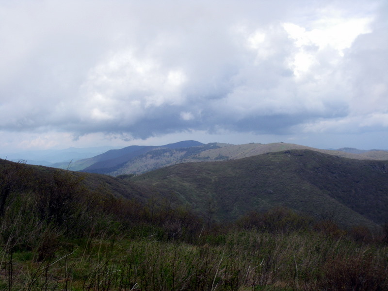
Some of the trails are runnable here and some are not, but it was pretty easy going. Around 4pm I reached the summit of Tennent Mountain and set the camera on timers to take a few shots of myself. Come off Tennent Mountain, I was alarmed when the trail led me eastward toward an another set of ridges, all the while I could see another trail in the distance climbing up toward the northbound ridge that I need to go. Not wanting to make a mistake, I turned back and climbed back to the summit of Tennent Mountain and found a plaque confirming where I was, and the map then verified that the trail will eventually turn back from the eastward direction on Ivester Ridge toward then Grassy Cove Top which is where I need to go. Happy that I’m not lost, I took a picture of Looking Glass Rock that’s visible in the distance toward the southeast.
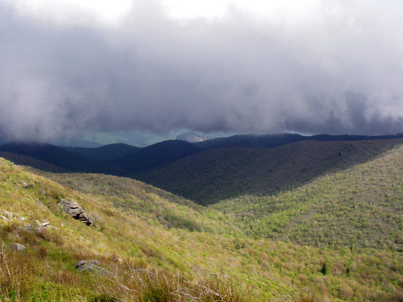

Running down as much as possible on big and small boulders and after an obvious trail junction, I arrived at Ivestor Gap where the Shinning Rock Wilderness starts and the very last trail sign points toward ALT. There are six trails that intersects within a few hundred yards of this spot, so I was super careful about not taking the first two rights, and really paid attention that I followed the contour line that wraps around Grassy Cove Top on the east side. The trail heads east first then wraps around the bald heading north. I kept the compass in my hand the whole time here checking directions. Just over a mile past the trail junction, I came across two backpackers coming toward me. I asked if they knew how far Deep Gap is, and they both looked at each other and said that would be on the Art Loeb Trail, and this is not the Art Loeb Trail. It turns out they had climbed up from Hwy 276 via Grassy Cove Ridge Trail and had hoped to eventually camp along the ALT. Crap! I turned back and ran along the wet and swampy trail looking for anything on my right that remotely looked like a trail. A couple false leads later, I found a well worn but tiny trail not even a hundred yards from the big trail junction that leads to the correct direction. Apparently the ALT is the tiniest of the trails around here. Happy that I survived this confusing trail junction, I ran as much as possible toward the next confusing spot, the trail junction near Shinning Rock.
Along the way, I passed a few backpackers already setup camp near Flower Gap. The trail here is super nice and I really enjoyed running and also the beautiful scenery and miles and miles of mountains visible around me. It was a wonder that the weather was nearly perfect, some rolling clouds but none are low enough to sock in the mountain, and pretty much no rain to speak of. Near Shinning Rock, I came across a beautiful clearing and thought to myself this would make a superb camp and wondered how come no one is using it. The map showed five trails in the trail junction just before Shinning Rock, so I stopped admiring the views and started to pay attention. Soon enough in the thick rhododendrons, the trails splits in two, veering left and right. The map showed two trails on the right of ALT, so I take the left split and continued to climb until I reached the base of a huge white quartz rock and the trail disappears. I searched the entire area for the trail and concluded the only possible route northward was a crack in the rock that climbs 20 ft up to the top of the rock. The climb was hard on wobbly legs but soon I was on the top and circling around looking for a way down. Soon I was on the west side looking down at what looks like a trail leading north west. Ok, this could be it, but between me and the trail is a 20ft cliff. I carefully climbed down the rock, and followed the trail into a wall of rhododendrons that’s impassable. Crap Crap Crap! Retracing my steps to the base of the cliff, I couldn’t find a way around it, either on the north side or south side. So the only route back was climbing back up the stupid rock. I would later learn that this pile of rock is the Shinning Rock.

There really isn’t a good way to get down on the south side so more free climbing is required. By now I was getting sick of this rock. Finally made to the bottom of the rock, I eventually found the trail that I came up on and retraced it all the way to the split. The logic goes if the left side dead ends, then the right side must be the trail right? Taking the right side I climbed higher and eventually came to a small camp with two trails leading off. Ran down the trail on the right a bit and realized it started to fall off the mountain, no good since I need to stay on the ridge. The trail on the left immediately splits into a couple trails. Taking the left split, somehow after some really thick rhododendrons, I end up at bottom of Shinning Rock again. Crap Crap Crap! Really couldn’t find my way back through the rhododendrons so I went all the way down to the bottom trail split, then climbed back up the right side to the small camp again. This time taking the left trail then the right split, I found another camp a few hundred yards down the mountain, and now the trail heads north! From this camp, two trails leads off, one northward, one northwest bound. The northern trail eventually bears east and down the mountain, so this is probably Old Butt Trail, no good. The northwest trail ends in a super steep area with no apparent trails leading off from it. By now it’s past 6:30pm, and things are not looking good. I have no idea where the ALT is, and only two hours of day light left to find the ALT, run 3 miles to Deep Gap, and 3.8 miles down from Deep Gap to reach camp. Pretty much giving up the hope of getting off this mountain, I remembered seeing a tent at Flower Gap about a mile back so I headed down the mountain toward it hoping to find someone to hang out with for the night.
The irony of this situation does not end, and on the way down I somehow lost the trail again and ended up once more have to free climb Shinning Rock for the final time. Just past the first trail junction, I saw a couple hikers off to the left near a cliff hanging out. They looked pretty friendly so I went over to talk to them. Turned out they had just arrived from Deep Gap! Holy Crap! They knew where the trail is. Two of them were nice enough to offer to show me, and led me southward to the clearing where I thought was a nice camping spot before. And in the trees on the west side of the clearing, two faint trails leads off! The right side is the ALT, and the left side is Little East Fork Trail. It had taken them two hours to hike from Deep Gap to this spot, but given my light load, they were confident I could get to Deep Gap before sunset. I thanked them for saving me, and took off running northward on the ALT at 6:45pm.
Surprisingly, the trail is extremely flat and runnable. 30 minutes later, my GPS died. Oh well, time to rely on stone age gear. The trail then ascends a small peak and ends up on a ridge called The Narrows. The top of the ridge is about 5 to 10ft wide at most, and both side drops off steeply at least 45 degrees. The view here is absolutely stunning, and sun shining from my left. At one point, I stopped to take a picture on both sides, and realized I probably could see Camp Daniel Boone on the left if the sun wasn’t shining into my eyes.


The thought about the IPA that’s waiting for me at camp renewed my spirit. After The Narrows, the trail drops steeply and shortly after comes out to a clearing that the hikers had told me is Deep Gap. I looked at my watch and it said 7:51pm.
There was a tent there and a hiker chilling out. I spoke with him for a few minutes, verifying the location and trail, and took off down the left side heading steeply down the mountain. Though this section is all down hills, it was not particularly runnable, very steep, and full of rocks and downed trees to jump over. The ALT descends 1800ft from Deep Gap to Camp Daniel Boone in 3.8 miles according to the map. Soon it was dark enough to get out the headlamp, and a few minutes later, I took the last sip from my Camelbak. There were a few streams to refill from, but it would take 30 minutes for the water purification pills to work, and I figured by then I would be at the camp drinking IPA. It was actually very peaceful going down the mountain at night, listening to critters waking up and going about their nightly business. I knew people at the camp especially Jade would be super worried by now. But there wasn’t much I could do about that, except to make it down safely. Running down at night was out of question from a safety point of view. A single slip around here at night would be a catastrophe.
Soon the compass indicated I had made the final left turn and heading south toward the final switch back of the trail. About 10 minutes later, I heard voice below me, and saw a couple headlamps. I yelled to get their attention, and it was Jade and Damian coming up to check on me. I was maybe sixty or seventy feet directly above them, and I yelled that I would soon turn down the switch back and find them there. Somehow among the excitement I missed the right turn down the switchback, and end up on a very faint trail heading across a ridge. Eventually the trail disappeared, and I turned around and realized I couldn’t really tell where I had come from. Thinking that Jade and Damian were on the road below in the camp, I figured instead of attempting to retrace my steps, I could simply head straight down the hill through the vegetations and find the road. Five minutes later, it was obvious the strategy was a bad one. I was on very steep hills, among greenbriar thorns and poison ivies, and generally have to hang on to thorns and ivies to prevent from slipping off. Eventually I heard Jade and Damian’s voice again, and soon saw their headlamp above me. It wasn’t long before I joined them on the trail and turned out we were still almost a mile from the end of the trail. Good thing I didn’t continue to bushwack my way down the hill. I was super happy to see them, but I think Jade was far more happier to see me.
We emerged from the trail at exactly 10pm, and Hayley was there to give me a ride back to the camp half a mile away. I was the last person off the mountain. Hot dogs, burgers, chicken and IPA have never tasted so good.
The Art Loeb Trail is a stunning place to run. Amazing views, very few hikers, and extremely challenging. I would not come back here without carrying proper survival gear, even though I know the trail very well by now.
Saturday, April 23, 2011
Is my leg coming back? Slowly yeah
I took two weeks off after Umstead 100 to let my body, and especially my right leg to recover. The Poloar Care 300 is the bomb when it comes to treating inflammations. The first week of my recovery is pretty much living with the Polar Care unit whenever I'm home and awake. Second week I walked around normally and generally felt better. Then I read some of my U100 friends went out and did a 24 hour race on April 16, ok, I feel wimpy now but also inspired to get off the couch and try something.
First run was Friday, April 15th. Jade is in Florida visiting her family, so no one can tell me it's a dumb idea to try to run. To minimize embarrassment, I got to the park at around 8 when it's just getting dark, so no one can laugh at my slowness. 7 miles around the race course loop, and slow as heck, with skyrocketing heart rate and right leg still feel weird.
This week, I decided to stay with that distance but try various surfaces: bridle roads, single tracks and road. 4 runs of 6 to 7 miles so far this week, and the right leg is improving on each run, while the heart rate is coming down slowly as well. Plan to do a 16 mile run on Sunday at ATT to see if there is any endurance left.
So there is a slim hope that I may able to do ALT 50 on May 15th after all.
Wednesday, April 6, 2011
Lessons from Umstead 100
So let’s go over what went well first to make myself feel better. Pacing went well. With the issue of right leg, I would never know if I could hold up the pace in the second 50, but the first 50 even though was mentally draining, was not physically difficult. Eating went extremely well. I was never hungry or lack in energy. Mentally I was alert, no one saw me ever said I looked tired. I was able to talk and joke with people all the way up to mile 70 when the right leg self destructed. Hydration and electrolytes management went well. I averaged one tree watering per lap, and never felt thirsty or any sign of dehydration. The amount of salty food I was eating and Saltsticks kept me feeling good. Never any signs of cramps.
What did I not do well? Quite a few things.
First, I relied on myself too much rather than seeking help, before the race and during the race. I guess it’s just part of my nature, learning and researching things on my own and trying them out. I was happy with Jade cheering me on and ordering burgers from the aid stations, and fetching gears for me from the bags, and really nothing else was planned with her and my pacers. I didn’t even tell her which bag had what gear in it beforehand. I even told her to take Canyon for a walk, and take a nap here and there to not get too worn out, and don’t worry about if she misses my stops. I basically told my pacers that their job is to run with me, and keep me entertained. Nowhere did I tell them that they should also check my body, health, eating, drinking, gear, etc. I was too independent, and didn’t have the knowledge and experience to back up that up. I think I got this attitude when I paced Darryl last year and saw how he pretty much took care himself, and as a pacer my job was mainly to keep the conversation going.
Second, I did not know much about blisters and blister management. A small blister caused me to change my running mechanics, which led to strained hamstring and tendon that I ignored for too long, and led to my DNF. I did not realize just how much a 100 mile race will amplify even with the tiniest problems and weaknesses. I had a perfect race at Weymouth Woods, and it led to overconfidence.
Third: making that time table in hindsight was probably a huge mistake when I had no one else to back me up on my decisions throughout the race. Once I realized how close I was running to the schedule, I subconsciously did not want to stop to deal with what I thought at time small problems and get behind from the schedule. During lap 5 when I realized I was truly falling behind, I made the decision that I must stop to deal with the blister. It was too late.
So what I have learned? I know nothing about blisters and feet. Must address that issue. Changing running gait is a disaster waiting for happen, never do that even if that means making a blister worse, since you can fix a blister but cannot fix catastrophic muscle damages. If I have a crew, rely on them, make detailed plans, and don’t be too independent and assume I can take care of everything. Mostly, I have so much to learn about running long distances.
Crash at Umstead 100
Race week. I run into Lady Luck on Thursday, when my classmates convince my professor to move the Monday morning exam to Wednesday. So the pressure to study for an exam after a 100 mile race is off my back.
Friday evening. Erika and her husband Nic from Maryland stayed with us. We met them at Weymouth Woods 100k and Erika is also running her first 100, and Nic is supporting her. Everything is packed and in bed by 10pm.
Saturday. Actually got a solid 5 hours of sleep, which surprised me. We get to the race headquarter and park our bags at table with Darryl, Linda, BD, Dana, Angela, and Judy. It’s the table closest to the fire place.
Race started at 6am with us still in the lodge, which was fine with me since I took my jacket and hat off and wearing a short sleeve with arm sleeves, long sleeve, and ¾ CW-X compression pants with gloves. No hats. It was in the low 40’s. Most of the back of the pack fast walk the ½ mile to the top of the hill near the gate to the camp, and we start running when we turned toward the water fountain and airport spur. Unlike some other races where I skip the walk break initially to warm up, I decide to immediately settle into the interval. No headlamp, since it’s only dark for 30 minutes and the surface is excellent for running blind. I really couldn’t see who’s who around me so I focused on keep my feet shuffle at what I feel is around 180 to 184 cadence. Around mile 4, Darryl, Dana, Judy and BD pass me near the Graylyn intersection.
Soon I feel in pace with a runner that I have seen many times at Umstead and always waved but never officially met. Mo is her name. She’s attempting her first 50. Not much further up Reedy Creek, Angela also fell into our little pace group. Angela is also attempting her first 50. The three of us cruise the first lap together, and back and forth we would pass and get passed by Stephanie and Valerie, sisters and both attempting their first 100. Lauren, another 100 virgin, is not far behind us. The three of us finish lap 1 at 8:32 on my watch. Perfect. With the congestion at start of the race and extra 0.1 miles on lap 1, I nailed the first lap pace, and it was effortless. My eating was fine, and I mainly stuck to sweets the first lap, fruits, banana bread, etc.
I took off my long sleeve before heading out for lap 2. Somewhere around north Turkey Creek, Angela eases ahead of us and eventually disappears. Her goal is 10 hours so I wasn’t surprised when she made the move. Mo and I stuck together, near the vicinity of sisters and Lauren. We would finish lap 2 at 11:10 on my watch. Still the same 2 minutes lag, so my lap 2 time was within one minute of my best case scenario.
Mo had to clean her shoes, so I leave for lap 3 on my own with a cheeseburger in hand. In a way, it was nice to finally be able to really focus on how my body is feeling. The first 5 miles go by without any issues, and I enjoy seeing many friends including Charles, Jeff, Erika, and others on the out and back section. Nearing the top of Reedy Creek Lake hill near mile 5, I felt a bit of tenderness in my right heel. I made a mental note that I need to check it at end of the lap, and also to change my socks. I never changed socks at Weymouth and there was a patch of very white skin on the sole at end of race. I certainly didn’t want that here. Aid Station 2 wasn’t serving soups yet, so I grab a turkey sandwich and some snacks and a Mt. Dew.
Around the back of the course, I hiked a bit slower on the Sawtooth section, knowing I have an extra 8 minutes in my plan for this lap. Coming up toward Cemetery Hill, I see Jade with Canyon on the side of trail taking pictures, which really brought up my spirit. She hiked with me to the top and then I took off running back to the lodge and end of lap 3, at 1:56 on my watch. Still the same 2 minute lag from lap 1, body wasn’t working hard, could this really happen, a 24 hour finish?
I run into the lodge to change socks and check my feet and saw our friends Tina who came out to support us. I gave her an update on my progress and she helped me take off my shoes. A deep blister is in the very initial stage of forming on my right heel. Erika’s husband Nic is also there to help me. I really don’t have much experiences dealing with blisters, since I never really had much. Note this small blister the step 1 of the cascade that eventually lead to my demise. When Nic suggested body glide, I figured that sounds good, reducing the friction on it. I put on a new pair of socks, changed into a fresh t-shirt and off I went, after grabbing a burger and chicken noodle soup. This stop had taken me 9 minutes, when all the previous stops were 2 minutes.
In hind sight, I definitely should have asked the medical staff to check the blister and dress it properly. Two things stopped me from getting help. One, I was ignorant about the how much a blister can change a race. Yes I have read about it, but never had really experienced the ugliness on my own, it was all academic. Two, I was nailing my best case scenario schedule, and body was feeling like not working much at all. Deep inside my head, a messed up brain cell is telling me to avoid get stuck in aid stations and keep nailing my lap splits.
I run into Jade and Canyon twice at the water fountain as I made the round of airport spur to start lap 4. Body still feels great. But I’m concerned about not making the blister on the heel any worse. So either consciously or unconsciously, I started making my right foot landing further and further toward the toes and not letting the heel touch the ground. Basically running tiptoeing. This is step 2 of my demise. Just before Cemetery Hill, I saw BD coming in on lap 4. I checked my watch and realized he’s going to hit the 50 mile mark in under 9 hours. Holy crap. Then BD tells me he’s done for the day, just not his day. I get a little sad. I was truly looking forward to see him crack that 20 hour mark. He’s such a great runner and the nicest guy.
Lauren eventually caught me on south Turkey Creek and passed me, obviously feeling very good. I stuck to my pace, wasn’t willing to deviate from my plan, though I would have liked her company. James caught up to me and I ran with him for a bit, talking about his cold, this race, chit-chats. Eventually he passes me as well when I had to water the tree at about a mile before AS2.
Rest of lap 4 was done completely on my own. I get a bit of mental low nearing end of the lap but was really looking forward to starting lap 5, knowing both Dave and Jessie will be pacing me and Canyon will be running with me as well.
The heel blister doesn’t seem to get any worse with my new running style. However the right hamstring was slightly tender. But having a bit of tenderness at 50 miles is not exactly cause for concern, is it? Step 3 of my demise.
Finishing lap 4 at 5:02 on my watch. I’m now 13 minutes behind my fantasy schedule. Not too bad for 11 hours of running, but most of that were lost on this one single lap. The long stop at end of lap 3 had a piece of it, but I know I was slowing down a bit more than the fantasy schedule.
Jade greeted me with her customary loudest cheer at any aid stations. Dave and Jessie are ready to go, and they decide to bring their dog Aiden along as well. Aiden is a superb running dog, and given the right weather, he could easily do the 100 mile! I also see Crystal, my lap 8 pacer, getting ready to go out for Stephanie’s lap 5. My neighbor Chris and his daughter also came out to see me. This stop really got my spirit up. I change into my Weymouth long sleeve shirt, grab a potato soup, Mt. Dew, and half a cheese burger, and three of us and two dogs take off down the trail. I didn’t bother to even think about getting someone to look at my blister, and to figure out why my right hamstring was a bit tender. Step 4 of my demise.
The first half of the lap went quickly with Dave and Jessie, chatting about all sorts of things. Climbing the long hill toward mile 5 after the lake, I noticed my right hamstring was getting worse and told them about it. I start to try to sort out why it is the case and after a bit connected the dots between the heel blister, tip toeing, and now tender and sore hamstring. I told them that when we finish this lap, I will need to get this problem addressed. Now this was all before AS2, so why didn’t I deal with it there? After all, they do have medical staff there. Again, wasn’t thinking clearly. Step 5 of my demise.
Ate my usual Mt. Dew, potato soup and cheese burger at AS2. The downhills on north Turkey Creek is now getting very uncomfortable for my right leg and progress is slowing down due to the right leg. Ok, this is getting serious. Damn.
I also didn’t think we’d get back after dark. With my newly acquired slowness, we made it to the water stop at Graylyn and Reedy Creek when it got completely dark. Darkness really wasn’t an issue on Reedy Creek, but it made running impossible after the turn at gate toward the lodge down the rocky trail. Finally we made it back to the camp at around 8:30-ish.
Jessie is done and I asked her to make sure Jade get some rest after Dave and I head out for lap 6. I worry about Jade wearing herself out helping me and others and also had to take care of Canyon.
Back at the lodge, I immediately asked a race volunteer about getting some medical help and within 20 seconds he was there. We decided to do this in the lodge so I can also change clothes and get something to eat while he works on me. The blister on the right heel is now much bigger than 25 miles ago, despite my tiptoeing effort to protect it. And a smaller heel blister is also forming on my left foot. After much discussion, it was decided to not pop them. He dressed both blisters while I ate, then I took some steps in the lodge to test them and they felt great. In my focus to get the blisters taken care of, I’ve forgotten completely about the right leg. Part of me probably thought once the blisters are taken care of, my gait will be back to normal and the issue with the right leg will go away. That normally happens on my run, if something is not right, I figure out why, correct it, and problem goes away. Only now I have abused the poor right leg for over 25 miles, and not realizing that it about to hit the point of no return. Step 6 of my demise.
Before I head out, Jonathan, a world class runner who’s volunteering at the race, check me over and pronounced I’m in good shape. I must have done a superb job of hiding the hamstring issue. He did make a note that I should bring more clothes, so now I’m wearing a long sleeve, a short sleeve, and Dave is carrying my jacket, gloves and a headband. I stick to my ¾ compression pants for now. Dave also brought his fleece top and gloves along for later when it gets colder.
The stop takes almost 30 minutes in the lodge nearing the roaring fire and we step outside at 9pm, and I immediately start to shiver. The inactivity and the heat of the fire had turned off my metabolism completely. So I immediately put on the jacket, headband and gloves and we head out. Both feet are feeling great, and legs also felt good from the rest. We manage to run most of the airport spur and warmed out bodies up and after a mile or so I was warm enough to shed the jacket and headband.
Running down Corkscrew hill, my right leg starts to act up again. The downhill pressure is definitely aggravating the hamstring, or at least it felt that way. I stopped running and start power walking again. Dave commented that I was walking much better now than the previous lap. I felt good about walking and decides I probably should give up running to protect the right leg. We hit AS2, mile 69.3 at 10:45 pm or so, I have 30 miles to go and over 13 hours left in the race. The 24 hour dream is obviously not going to happen, but I was confident I would finish in a decent time by walking rest of the race, probably around 26 to 27 hours or so.
At AS2, I take off my right shoe to address a rubbing of my toes and discover that the fourth toe is bleeding a bit. I clean it with neosprine and put a bandaid around it. After eating some soup and really yummy banana bread, Dave and I head out toward the dreaded Sawtooth 79 section for the 6th time of the race. I was cold from the stop at AS2, so we run up a small hill to warm up. Immediately my right hamstring complained, so we stop and I put on my jacket, gloves and headband. Walking toward the narrow section of the trail before the first big climb, I felt the right hamstring tighten even more. The climbing up that knarly hill caused so much pain that I had to stop at the top, and Dave attempted to stretch my right leg out gently with some success.
We start walking again but at a much slower pace, and within a minute the pain become somewhat unbearable. Multiple attempts to stretch out failed miserably. The sharp hills on that section was probably the worst kind of terrain for my condition and my right leg moved slower and slower and each step was getting more painful. I remember getting passed by a lot of runners at this point and every one of them lies to me telling me I’m doing a good job. Dave is doing his best to motivate me to make progress. I was getting cold from the lack of activity, so he takes off his fleece top and made me wear it under my jacket. I immediately felt warmer, though I was concerned about him wearing only a long sleeve shirt at this point, probably around upper 30’s to 40’. Dave assures me he felt fine and is not cold.
Going down the long hill toward the metal bridge brought out tears. All the sudden I remembered joking with friends about the Ivan Scale of Perceived Suffering that Jonathan had came up with shortly before the race, and realized I was probably moving up that scale nicely. Dave is now resorting to distracting me from my suffering by telling me one ridiculous story after another. Fortunately he’s no stranger to pain, having suffered some good ones in the past, so he had a good sense of what I was going through.
Once we got to the bottom of the hill and crossed the bridge, we face one of the worst hills on the course climbing back up to Graylyn. This brought out more crying and cussing. Our pace drops even further, probably to around 40 min mile at this point. Daniel passes by also not feeling good and stretching his calves along the hills but eventually he pulls away into the darkness. We slowly move along, finally making the left turn on Graylyn with a long flat section that quickens our pace to a bit faster than 40 min where the pain of making each step is reduced to something like a shallow knife stab. The sharp stabbing pain returns in force once we start going down Powerline hill. Here we run into Rhonda who is the assistant race director of the race patrolling the course on her bike. I immediately realize the seriousness of the situation, and holds back the cussing and tears and did my best to hide my misery from her, not wanting to get pulled and hence ending my chance of finishing.
That was very delusional thinking. The climb back to Reedy Creek was even more miserable if that was possible. I was getting cold and I can’t imagine how cold Dave is wearing only a long sleeve shirt. We both eat a couple snicker bars from the water stop there. The last 1.9 mile back to the camp was a bit of blur, I remember lots headlamps in both directions, and thought nothing could be worse than climbing Cemetery Hill. That changed when we turned at water fountain toward the lodge. The rocky downhill trail killed me. I gutted onward knowing the lodge is not far away. There are few steps right before we get to the lodge. If I was thinking clearly, I would have taken the steps with my left leg. But the body is now addicted to more pain, and naturally I stuck the right leg out down the first step, landed, and collapsed. Dave saw it coming and caught me before I crumpled. And soon Jade saw us and ran down the hill to help Dave getting me back in the lodge.
It had taken us 3 hours and 10 minutes to complete the 5.7 miles from AS2 to the lodge.
Guido who is the captain of the main aid station immediately came to my assistance. I didn’t know it at the time, that the tendon behind the right knee is now the size of an half buried egg. Guido started icing my tendon and told me to stay on ice for an hour, and at 3:15am, I can try to get up and assess my situation and making a decision. In the mean time, I wolf down a hot dog, two pancakes and some fried potatoes.
Jade, Sherri and her husband Brian, Crystal, and Jessie were all tending on me and chatting with me. That and the roaring fire almost made me think I was ok, maybe. Next thing I know it’s time to assess my body. Guido helped me roll onto my back, and that motion bought out a gut wrenching pain. He looked into my eyes and I shook my head, and told him my race number. My race is over.
Training and planning for Umstead 100
I’ve learned much through the process of training for a 100 mile run, and yet I have so much to learn.
First: Training and Preparation
My training has been inconsistent. I would have a great month, then either school or injury sets me back a month. Back and forth. But there are certainly a few quality long runs, and a few quality speed works. I made the best of my limited training time, every run had a specific focus. I end up averaging around 130 miles per month from December through March, probably one of the lowest among the people registered for the Umstead 100. Through my long runs and quite a few specific pacing runs on the race course, I thought I had my pace strategy dialed in. A few weeks prior to the race, I told my wife Jade and my pacers Dave, Jessie, Sherri and Crystal that I have a best case scenario timing table for the race:
Lap Starting time Lap time
1 6:00 am 2:30
2 8:30 am 2:38
3 11:08 am 2:46
4 1:54 pm 2:54
5 4:49 pm 3:03
6 7:52 pm 3:12
7 11:04 pm 3:21
8 2:26 am 3:32
This will put me at a 23 hours and 58 minutes finish. 2 minutes margin over 24 hours is a joke and I knew it, and I had told everyone as such. But I had to provide something both for myself and for my crew and pacers as a baseline.
I used my 3 lap run on the race course, and the result of Weymouth Woods 100k, to predict my slowdown factor. Both runs gave me a slowdown factor of 5.1% per lap. So based on a 2:30 lap 1 time, I came up with the above table. This pace gave a 21% slowdown between the first 50 and second 50, much lower than the average 30% that Blake Norwood reported at Umstead 100 website. However, the Weymouth result showed that even though I was the 32 among 47 100k finishers, my slowdown factor ranked me 8th in the field. So I was confident that my pacing would hold up over the race.
I kept telling myself and everyone that asks me about the race, that my primary goal is to finish the race, and if that happens, then a 24 hour finish would be lots of icing on the cake. I wanted to make sure I know what is my primary goal.
I focused on some aspects of a 100 mile race more than others. I thought pacing and nutrition was important, and speed through aid station was also important. I have read about other things such as blister management, hypothermia, crew, pacers, etc. But never really know what to do about them except that they’re important in an academic way.
Pacing and nutrition come hand in hand. There is an effort ceiling, below which I can eat pretty much anything and able to digest and keep them in. Above that ceiling, many foods don’t sit well. Too far above that ceiling, nothing stays in.
So in order to run at a decent pace and still able to eat, I had to train to run faster comfortably. I figured a 7 min pace marathoner’s eating ceiling is about 10 min pace. So in order to keep the initial lap at 12 min pace, I need to get my speed up to the point of approximately a 9 min pace marathon, or around 4 hours.
Toward end of training, I ran with the 2 hour ½ marathon pace group at Tobacco Road Marathon. It certainly wasn’t effortless, but it wasn’t hard. I figured on that particular day, I probably could go all out and run no slower than 1:50. So now I feel somewhat confident that I can hit a 4 hour marathon mark, and at 12 min mile pace during the 100’s initial laps, I can keep food in me.
There are also quite a few practice laps around the race course, with 2:30 as the ultimate target and very much trying to get the body to learn that very specific pace on the race course. It’s the home field advantage that will be my not so secret weapon. Toward the last month or two, I was consistently getting within 2 to 3 minutes of 2:30, using the strategy of walking up all the hills, and run 3:1 interval on flats and downhills. Very happy with that.
Between eating mainly PBJ, bananas, and pretzels during my training run, and eating everything in sight at Chattooga 50K, Medoc Meltdown, New River 50K, Weymouth Woods 100k, and Pilot Mountain Payback, I learned that I can handle a tremendous variety of food, and that Mt. Dew really go well with me and keeps me alert.
Hydration and electrolyte plan is using the 22oz Nathan bottle, and take one Saltstick capsule every 2 to 3 bottles, and ease off that schedule a bit if the food are really salty. I need to drink enough to urinate at least once per lap, but any more than that, I’m over drinking like I did at Weymouth where I urinated every 5 miles and was very annoyed.
Nothing else left to do, time to run.
Subscribe to:
Posts (Atom)