I originally was torn between running the Cocodona 250, The Bear 100, or the brand new Silverton Ultra Dirty 100 in 2021. At the end, Silverton won out. Cocodona is early in the year and I generally spend the first few months of the year skiing. Also I don't have a crew for Cocodona and the logistic of a 5 days race without crew is rather daunting. I always wanted to run in the San Juans, and Silverton is closer than Utah.
Training started in April with an interesting run up Rampart Range following a bear's post hole track, a nice snowy run in Cheyenne Canon, a hot desert 30 miler near Seep Springs where I carried 4 liters of water and ran out the last few miles, and Dionne showing me Waldo Canyon at the end of the month.
 |
| Pikes Peak from along trails high on Rampart Range |
 |
| Snow and ice in Stanley Canyon |
 |
| The iconic view of Sangres from Island in the Sky at Oil Well Flats |
 |
| Island in the Sky |
 |
| Cliffs at Seep Springs |
 |
| Valley between Seep Springs and Shelf Road |
 |
| Seep Springs trail |
 |
| Columbine Trail, North Cheyenne |
 |
| Kineo Summit |
 |
| Captain Jack's, trackless |
 |
| Dionne working out her descend at Waldo |
 |
| Dionne atop a huge quartz formation overlooking Hwy 24 |
May was a mixed of training and preparing for two multi-day rafting trips. We had the raft for a couple years but never fully prepared it for multidays. Finally this year we got invited on two trips, 6 days on the San Juan, and 7 days on the Deso/Gray. Every weekend of May was consisted of one day running, and one day working on the raft rigging. Kids got to watch a lot of TV's while the rigging was improved in the garage. Notable training runs includes a finally making a loop out of the Lake Moraine Trail and meeting Todd (famous Hardrock 100 runner), Three Canyons (Hurricane, Waldo and Williams), and a meandering run around Kineo.
 |
| Cherry blossom at Manitou Memorial Park |
 |
| Todd's first time on Lake Moraine Trail |
 |
| Pikes from Lake Moraine Trail |
 |
| Pikes view from Waldo Canyon |
 |
| Racing the storm |
 |
| Williams Canyon |
 |
| View on Kineo Summit |
 |
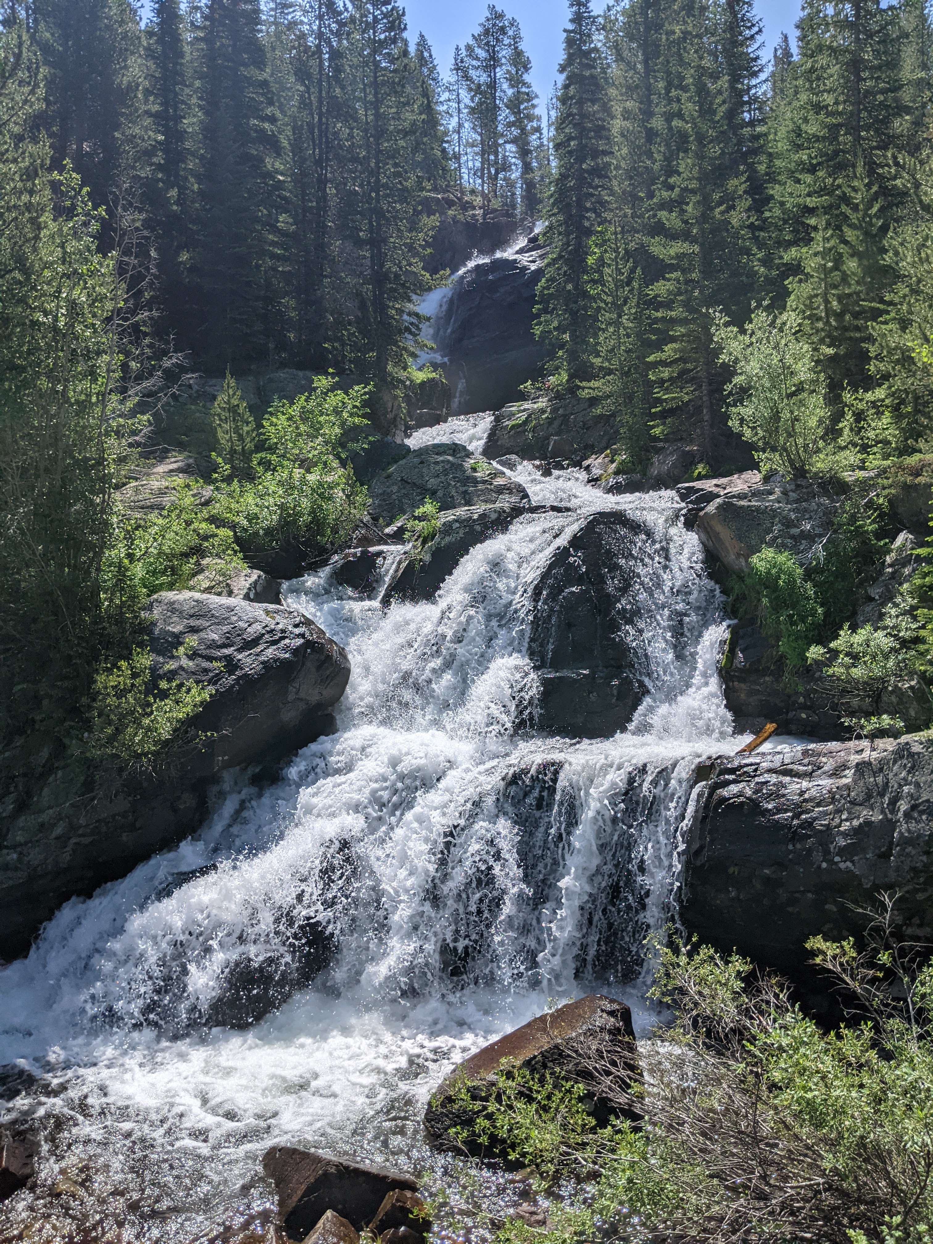
| Discovered a water fall along North Cheyenne Creek |
 |
| Caught in a graupel storm on Buckhorn |
Most of June were spent traveling to the rivers and pulling a loaded raft down river. My shoulder/core/arm strength improved dramatically while leg muscles shrunk. However last weekend of June was a scheduled four day running camp in the Sawatch Range. First day of the camp was derailed when friends came in town to visit which still left a healthy three days to run. On day 1, I found a new loop climbing the east ridge of Yale then connecting over Brown Pass and down Kroenke Lake. On day 2, I drove over Leadville to Copper Mt. and ran with some new friends to celebrate Amanda's birthday. Amanda is also running the Silverton 100. At end of day 2 it was cold and pouring so I drove home to sleep in a comfy bed then did a the big loop around Rosa. The three days total was 71.3 miles, 18,000 ft climbed, and 26 hours on the trail. Pushed the effort on day 2 but the other two days were relaxed. Amazing thing was I wasn't too sore or tired after this.
 |
| Sunset on the San Juan River |
 |
| Amelia and Annabelle's yoga session |
 |
| Last night on the San Juan, hiked up to the river rim to discover Monument Valley visible in the distant horizon |
 |
| Amelia and Jade paddling on the last day on the San Juan |
 |
| Day 1 on Desolation Canyon |
 |
| Deso-Gray |
 |
| Amelia SUPing on Deso |
 |
| Deso-Gray |
 |
| Cloud in the valley, seen from Yale's East Ridge |
 |
| Yale's summit in view |
 |
| Yale summit |
 |
| Wildflowers blooming on Yale |
 |
| Climbing toward Brown's Pass |
 |
| Almost at Brown's Pass |
 |
| Brown's Pass, nice snow bank blocks the way |
 |
| Lake Kroenke |
 |
| Snow bridge collapsed while I crossed it |
 |
| A curious marten checking me out |
 |
| Siri and Kate at misty lake on Gore Range Trail |
 |
| Gore Range |
 |
| Uneva Pass, Gore Range Trail |
 |
| Descending Uneva Pass |
 |
| Eccles Pass, Gore Range, Amada's Birthday Run |
 |
| Below Eccles Pass |
 |
| Cover photo for the birthday run |
 |
Lilly's pond. Dave (2nd from left), Amanda (3rd from left) would finish their respective Silverton 100M and 100K. Roger (2nd from right) would go on to finish his umteenth Hardrock
|
Jade and I celebrated her 50th birthday with a double hike on Pine Creek and Mt. Columbia at beginning of July while the kids were at their first overnight camp in Como. Each day we would turn the phone off airplane mode at end of the hike and anxiously wait for the dreaded message from the camp to come to get our misbehaving kids. Fortunately, they behaved well at the camp, much to our relief. I also got to check out Pawnee Buchanan Loop. Jade's family came to visit at end of the month and we made a trip to Mt. Princeton Hot Springs to soak and I used that as an excuse to explore the Monarch Crest to finish off the training.
 |
| Old mining cabin on Pine Creek |
 |
| Jade making a precarious creek crossing |
 |
| Pine Creek |
 |
| Wildflowers on Columbia |
 |
| Jade climbing up Columbia, Lake Kroenke and Birthday Peak in the distance |
 |
| Columbia suummit |
 |
| Sunrise on Pawnee Buchanan |
 |
| Buchanan Pass |
 |
Buchanan Pass
|
 |
West side of Buchanan Pass
|
 |
| Sunflowers covering an avalanche chute |
 |
| One of many cascades on the Pawnee Trail |
 |
| Lone Eagle Peak |
 |
| The wall at Pawnee Pass, looks impassable the trail goes up there somehow |
 |
| Confidence marker on the CDT/CT near Lost Wonder Hut |
 |
| Sunrist at Hung Lake, CT/CDT |
 |
| Almost on the CDT ridge |
 |
| CDT/CT ridge |
 |
| CT wonder |
 |
| Monarch Crest |
 |
| Monarch Crest |
 |
| Wildflowers on Fosses Creek Trail |
Despite the interruption in May and June, I finished the training feeling supremely confident. The volume and vert has been higher than ever and I was not feeling fatigued after long mountain runs. I spent many hours long alpine ridges which made me feel like I was ready for the Silverton's long exposure at higher elevation.
My race logistic caused quite a bit of anxiety. Originally Jade was going to crew me while leaving the kids with my parent, and we reserved a hotel room in Silverton for this plan. The in the spring my parents suggested they should all go to the race and cheer me on. We cancelled the Silverton hotel and reserved a 2 bedroom condo in Cascade Village near Engineer Aid Station at mile 73. In June my mom suffered quite a few medical issues that still wasn't resolved by July, so they bailed on the race and we lost the option of leaving the kids with them for the race weekend. Jade's mom made plan to stay with us from July through October so the new plan is for Jade and her mom to take the kids to the condo and Jade can crew me and drive us home afterwards. When Jade's mom flew in from Florida in mid July, she immediately struggled with the elevation in Colorado Springs. We couldn't leave her alone in Colorado Springs, so the new plan is I go on my own, and have to figure out how to get rides from the finish to the start, etc. But miraculously Jade's mom quickly adapted to the altitude and we did a trial day at Mt. Princeton Hot Springs 2 weeks before the race, and she handled the 8,300 ft elevation fine. So now we felt confident she would be okay at Cascade Village, elevation 9,000 ft.
Jade's crewing duty also dwindled over the months as we researched the race course. Other than Engineer aid station - mile 73 which was right by Hwy 550, the other aid stations were either hike in only and no crew allowed ( Dry Fork - mile 6.5, Rolling Pass - mile 63, Bandora - mile 91, Putnam - mile 97), or high clearance 4WD required (Kennebec - mile 21, Big Bend - mile 35, Hermosa Peak - mile 52, Cascade - mile 56/82). The only two aid stations were somewhat reachable with our Chevy Suburban was Champion Venture (mile 18.7, added only two weeks prior to race weekend) and Hotel Draw (mile 42). We thought about having Jade meet me at Hotel Draw but that would mean for her to drive an hour on a dirt road with a creek crossing at 2 AM. Jade is not the best off road driver and is horrible at navigation. So at the end, we decided to only have her crew me at Engineer aid station. As a backup to the plan, in case the kids or her mom have issues, I would also have a drop bag at Engineer with everything I need.
In the end, I used three drop bags.
Drop bag 1 at Kennebec at mile 21 which will have all cold weather and night gear with the goal of reaching it at 9 PM on Friday. It also has 8 bags of Tailwind and 4
Lady's Bars.
Drop bag 2 at Cascade Creek at mile 56 and 82. Plan to reach it on Saturday morning, drop off cold weather and night gear, then reach it again in the afternoon and pick up the cold weather and night gear.
Drop bag 3 at Engineer at mile 73. Extra food and headlamp in case I reach it late and need the light to get back to Cascade.
We drove to Cascade Village on Wednesday, finally settled in around midnight. I really wanted Jade and kids to see the race course so Thursday morning we went to Engineer aid station location and hiked a few miles of Cascade Creek Trail which was around mile 73 to 75 on the race course.
 |
| Start of Cascade Creek Trail |
 |
| Wildflowers everywhere |
 |
| Not sure what Amelia is trying to do here |
 |
| Massive aspen grove |
 |
| Kids are super good at finding huge mushrooms |
 |
| More mushrooms |
 |
| Alex going up! |
We decided to go sample the BBQ in Silverton for lunch, then found out the race needs help sorting through aid station supplies and it was next to the BBQ so we did just that, sorting through a couple million calories worth of food. Then it was off to the race briefing where we helped fixing the main tent that sustained damage from the afternoon microburst.
 |
| Breakfast with Amelia on the balcony |
Jade drove me to the start at Junction Creek and dropped me off. There are very limited parking at the start so the race mandated that runners are to be dropped off, and families and friends were not allowed to park.
 |
| Junction Creek Trailhead |
 |
| Got dropped off |
 |
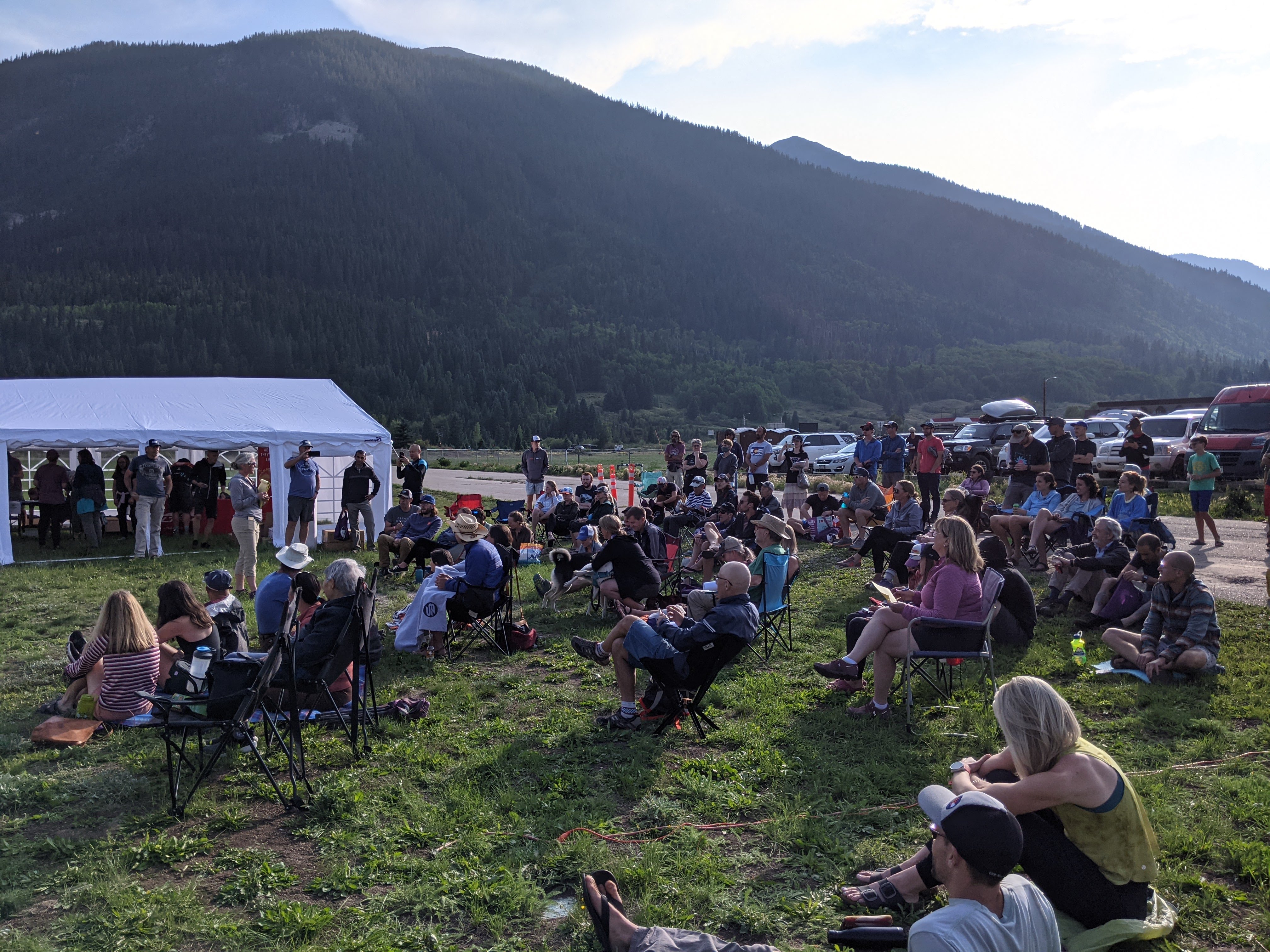
| Race start briefing, Megan ask for 100% finish rate |
The afternoon was warm in Durango. Junction Creek is at a low 7,000 ft elevation so we felt every bit of the 85' heat (Florida, Texas and Arizona runners can start laughing). The first couple miles I followed a group of 4 runners (Susan, Baron, Koren and Shari) up the Colorado Trail and discovered four out five of us have done the Never Summer 100K. It was good to swap war stories of that race and even though the pace was a bit faster than I would have liked at the start, I wanted the company of runners knowing I'll be alone for majority of this race.
I made the mistake of not filtering at the creek crossing just shy of mile 3 thinking there will be another crossing in half a mile. There wasn't. I started ration the 2L I have knowing the next water source will be at 14.4 miles. When we got to Dry Fork aid station, we had a surprise, there were few gallons of water. We were told since the horse went lame, this aid station will only have a bit of snacks. The volunteers helped me refill my bottle with a Tailwind bag but somehow I left the second bag of Tailwind mix on the aid station table. I didn't realize this until a mile later.
Dry Fork Aid Station, mile 6.5: 3:48 PM.
At Dry Fork the posse of runners that I was part of departed earlier than me. Here I ran into a couple other runners, cousins Koren and Alex. Koren was from Flagstaff and worried about the effect of elevation on her. Alex was here at keep her company even though he rides MTB more than he runs. He was some cousin! To my surprise I found a tiny creek flowing across the trail around mile 12 where I was able to filter a bottle of water. Koren and I ran down to the Junction Creek crossing at mile 14.4 where we caught up to Alex, and I chugged a couple bottles of water to take care my dehydration. The trail followed Junction Creek for the next few miles where I helped myself to more water until I felt the urge to go #1. I then caught up to Bryan and Oscar, both from Durango and committed to run the race together. They were faster than me and I had to let them go after chasing them for a bit.
 |
| Trying a selfie with Shari behind me, but somehow cut her off. |
 |
| Pretty aspens along the CT |
 |
| Aspen turned into mature pines |
 |
| Waterfall over a cliff in Junction Creek Valley |
The climb up the forest in the later afternoon was very pleasant. I was slightly ahead what I calculated for 34 hours pace. It was gorgeous just before the sun disappeared the western ridge.
Right before Champion Venture aid station, I caught Shari and Susan and the three of us made into the aid station together.
Champion Venture Aid Station, mile 19.3: 7:41 PM to 7:47 PM
Bryan and Oscar were there. I ate a ton of water mellow and some periogies, refilled with water and left before the others. The trail switched back above the aid station amidst wildflowers made up for the steep grade.
 |
| Colorado Trail above Champion Venture aid station |
 |
| Looking down toward east and Durango |
 |
| Champion Venture aid station 400 ft below |
The trail eventually left the trees behind and climbed through a steep scree field to a saddle and I caught the last bit of sunset there. Kennebec aid station was half a mile distant.
 |
| Colorado Trail cutting across the steep scree toward the saddle |
 |
| Sunset near Kennebec aid station |
I turned on my Kogalla light the last 10 minutes to Kennebec aid station.
Kennebec Aid Station, mile 21.9: 8:48 PM to 9:01 PM
At Kennebec, I worked through my drop bag, added the headlamp and extra battery, and throw the arm sleeve and long sleeve shirt on me. I decided against the running pants since it wasn't that cold yet so shoved that into my pack for later. I also reloaded Tailwind bags and Lady's Bars. At this point, my hydration pack had the following:
- Emergency kit (bandit, knife, headlamp, duct tape, Kinesio tape, needle, bivy)
- Rain pants
- Rain jacket
- Down vest
- Running Pants
- Med bag (ibuprofen and salt caps)
- Buff
- Waterproof mittens
- InReach Mini
- Collapsible cup
- Bladder with 1 liter of water
- Two 500 mL softbottle, one with Tailwind, one with water and BeFree filter.
- 7 bags of Tailwind
- 4 Lady's Bars
The amazing thing was despite how heavy it felt when I lifted it with my hands, once it was on me, and strap cinched, it was a very manageable pack. The modern hydration pack designs are truly amazing.
I ate two cups of chicken soup (lots of meat) and one quesadilla and a coke at this aid station. Stuffed two more quesadilla in a zip lock bag to go.
Aldo was next to me getting his gear sorted out. I said hi to him but he was too busy to engagement in a conversation except to grunt a bit to acknowledge my presence. I admire his tenacity, coming from Houston and sea level to run this race requires more brass than I could ever muster, and he had run the first 21 miles faster than me!
I left the aid station blazing hot, literally. My headlamp was putting out 400 lumen of spot beam, and Kogalla was putting who know how many lumens from the waist. The trail was turned into day light. Soon Aldo passed me then I soon passed him when he decided to strip off his jacket. I never saw him again until about 20 hours later.
The course climbed another 1,000 ft from Kennebec to the ridge proper on Indian Trail Ridge where the wind was howling a bit. I saw a bibbed racer running back toward Kennebec. I asked him if he was okay but he didn't say much. Later I found he went back to Kennebec and dropped there. Once the course rounded the high point, I discovered I prefer running down the rocky trail with only the Kogalla light luminating. Adding the headlamp gave me overall a better view of the environment around me, but washes out the depth perception somewhat of the rocks on the trail. For rest of the night, I only turned on the headlamp for looking at course markers, illuminating christmas trees, and looking for other interesting or useful objects (later).
I passed one runner that was walking down a hill. I think this may have been Yuki (with many Hardrock finishes and way too many ultra finishes) but in the dark I couldn't tell.
Some of ridge sections were super cool and spooky, only a few feet wide. When I shinned my spot beam to both sides, I saw nothing but dark voids. Would have been so cool to see this during the day light. I could occasionally see Yuki(?)'s light behind me, and I could make out three or four lights ahead of me over the next mile or two.
 |
| Kogalla waist light and Fenix headlamp makes for terrible night photography lighting |
After a few miles, the trail goes back into the tree line where I lose sight of other runner's lights, except at one point where I saw a runner's light a couple switchback below me for a split second. I also startled a large animal that crashed through the bushes making a ton of noise. By the time I turned on the spot beam, it was gone. Later I learned a runner named Tina saw a mountain lion in this section.
At some point, the trail winds through an open section with huge christmas trees all around me. It was a super cool thing to see. There are also mushrooms everywhere.
I ate one Lady's bar plus one bottle of Tailwind through this section and arrived at Big Bend aid station to see Barton, Jake and Tsuyoshi at the aid station. Tsuyoshi was the light just ahead of me the last 10 miles or so. Jake took off right away. I ate two cups of chicken soup, had some coffee and crackers. Tsuyoshi left just before me. Barton and I headed out together then I had run about 50 yards back to get my poles while Barton took a bathroom break.
Big Bend Aid Station, mile 36.1: 1:21 AM to 1:33 AM
I ran alone for awhile chasing Tsuyoshi's light during this section. He was obviously faster than me and his light slowly pulled ahead until I finally lost sight of him. It was during this section that I started getting very gaseous, and was starting to get winded more on the gradual uphill section. To be honest, this section was super flat with a final downhill to Hotel Draw aid station. I remembered what happened during Run Rabbit Run and decided I need to find a place to take care #2 before things get out of control. Hotel Draw aid station was one of the easier to reach by volunteer and crew so I hoped there was a porta potty or vault toilet there.
Shortly before Hotel Draw, I checked my phone for Gaia for the first time during the race and realized I was off course and hasn't see a pink flag in awhile. But I was also still on the Colorado Trail which will take me to Hotel Draw. I continued running and half a mile later saw a pink flag! So the GPS track given on the website was slightly off in this section. I was glad I didn't have to retrace the steps.
I only drank one bottle of Tailwind during this 2 hours, and drank some water. Didn't have the desire to eat the Lady's bar.
Hotel Draw Aid Station, mile 43.2: 3:45 AM to 3:56 AM
I asked the volunteers at Hotel Draw about porta potty or vault toilet and was told neither are available. So it'll be another off to the woods thingy for me. My appetite wasn't great so I ate just one cup of chicken soup with some coffee. Crackers didn't taste good either. I saw Dave for the first time but didn't feel the energy to engage in conversation except to say hi. I mixed a bottle of tailwind and filled up the filter bottle and left the bladder empty knowing there will be water source on this long section.
Shortly after I left the aid station, my headlamp spotted a great looking down tree about 40 yards to the right side of the trail. I left the trail, jumped over some deadfall and cut my right knee and got to the tree. It was a good one. I just learned about this trick from Dan. I took off the pack and got the TP out and sat on the tree trunk with the rear overhanging the other side and turned off all the light. My god, it was the most comfortable poop in the woods I had ever done! I could have fallen asleep on that tree. After a few minutes and saw a few groups of runners/pacers passing by on the trail, I finished the business and went back to running.
It was amazing, so much more energy than an hour ago. I pulled away from the set of headlamps behind me and after 30 minutes or so caught up with a couple ahead of me just before Straight Creek crossing where I stopped to filter two bottles of water and mixed another bottle of Tailwind. I know there will be a steep climb coming up, and wanted all the Tailwind I can get because I don't tolerate solid food on climbs. The Lady's bar can wait until after the climb.
Soon I passed two a runner and pacer napping on the side of the trail, it was around 5 AM. It was getting cold, probably in the mid 30's, and I could see just a hint of light in the night sky. After climbing above the tree line, it was very cool to see a couple set of headlamps marching up above me toward the saddle of Blackhawk Pass which was about 5 feet shy of 12,000 ft. I made the saddle at 5:45 AM and saw the beginning of a very hazy sunrise. This is became a hint of what's to come this day.
Shortly after descending the pass, I caught up to Dave again and he said he was struggling with breathing on climbs. Despite that, he was walking down the technical trail faster than I was running down it. A couple backpackers stopped me to ask about water sources down south and I gave them what I know, which was a long 25+ miles of dry section between Straight Creek and Junction Creek. Another mile later, while not catching Dave, I decided my stomach needed another emptying. By now, it was light, almost 6:30 AM and I had to get further away from the trail.
Having gained experience from the earlier adventure in the woods a few hours ago, I decided to further improve the technique but this time resulted in a giant mess. In the process of cleaning up, I smeared some of it all over the righ thumb I did the best to rinse off the thumb with what little water I had. What I needed was a fast rushing creek to clean this up. Until then, eating was out of question and I didn't want get the mess on the hiking pole handle so I had to hold two poles in my left hand.
Barton passed me while I was struggling with this mess but I caught up to him. He was not the happiest person in the world and neither was I. So we barely exchanged a few words and quietly marched up endless rollers at near 12,000 ft in our miseries. After 3 miles, I finally found a stream where I could wash off the thumb to a reasonable degree of cleanliness and filtered more water. Only a mile from the next aid station, I decided to hold off eating until then.
Hermosa Peak Aid Station, mile 53.1, 7:42 AM to 7:54 AM.
Dave was there, not having a good time due to breathing issues. Barton was finally able to charge his dead watch from his drop bag battery. I sanitized my dirty hand with some alcohol wipes. I asked for breakfast and received a plate of two pancakes, two slices of bacon and scrambled eggs. I ate it all down and also drank two cups of coffee. Feeling pretty good, and saw that Barton and Dave gave no indication of moving soon, I headed out the aid station alone in a hazy but beautiful morning.
 |
| Shortly after Hermosa Peak aid station, gorgeous scenery despite the smoke |
About a a mile after the aid station, I started to feel tired and drowsy. I crossed some dirt road and stumbled into a mountain biker camp where one rider offered me a can of coke. Why not!
About half a mile later, I was half a sleep stumbling alone a dirt road and came up to a runner and her pacer. Later I found out her name was Tina. They weren't moving very fast since somehow I passed them while sleep walking. I missed the right turn off the dirt road onto the single track and the pacer yelled at me and got me back on track. The next mile climbed 500 ft to a ridge and took me about 35 minutes, during which I leaned over my poles and napped a few seconds here and there multiple times. I have never experienced this kind of uncontrolled sleepiness before.
The trail meandered down from the ridge, to the junction of Graysill Trail (the course circles back to this spot in 26 miles). Dave passed me here, and told me he's going to drop at Cascade Creek. I thought that was a great idea but had to get there first.
Cascade Creek Aid Station 1, mile 58.5, 9:52 AM to 10:45 AM.
I stumbled into the aid station and fell onto a chair. After a bit I told the volunteers I need to lay down and they scrambled to put together a comfy bed in the sun and I laid down on my drop bag as a pillow. About 10 minutes later, one volunteer checked me and agreed I needed a longer nap so back down on the bed I went. 20 minutes later, the volunteer woke me up again, gave me a full vital check and listened to my heart and lung and pronounced that I'm healthy and good to go. He gave me some water and tailwind and a grilled cheese sandwich, and filled up my hydration pack then more or less shoved me out of the aid station.
The first mile out of the aid station was pretty good, I slowly ran down the hill to the crossing of one of the forks of Cascade Creek, which was roaring. There was a party of backpackers there chilling by the water. The sleepiness was mostly gone. However soon I discovered I had no motivation to move with any authority. The next few miles hugged around the hill through the Cascade Creek drainage to a beautiful bridge crossing the creek. Somewhere around here the front runner passed me, about 26 miles ahead of my 60 miles. Soon the trail angled up toward Rolling Pass. 2nd place, 3rd place and soon 4th place runner passed me. The 4th guy and I had a nice chat, both thinking the trail is brutally hard but his version is harder by 26 miles and 5,000 ft. By now I had resigned to my pathetic pace, realizing there is a good chance I won't make a cut off somewhere along the course.
 |
| Cascade Creek drainage |
 |
| Cascade Creek, living up to its name |
The final 1,000 ft to Rolling Pass had a couple switch backs that hides the final ascend. The view of that ascend was totally demoralizing despite its beauty. I could also hear a bunch drunk people singing out super loud on the ridge top to my right, but could not see them at all. I was too tired to stop to get the phone out to take picture of the climb. Eventually at around 1:15 PM, I summited the pass.
 |
| Gassed at top of Rolling Pass |
 |
| The smoke hides Twin Sisters summit to the north of Rolling Pass |
 |
| The Colorado Trail winds it's way toward the Rolling Pass Aid Station |
Rolling Pass Aid Station, 65.5 miles, 1:35 PM.
I slogged into the aid station. Dave was already there, dropping. I saw Roger there helping the with water filtration duty at the aid station. A friendly volunteer helped me to some pancakes with Nutella and I sat down to slowly enjoy the meal. Turned out the volunteer, Julie, and I had some common friends and she had just finished Ouray the previous weekend. Wow, talk about tough! My race that I'm struggling through at the moment, is child's play compared to Ouray.
After about 15 minutes of resting at the aid station, I got up, made the decision to at least get to Engineer aid station, which lays 10 miles, 1,100 ft of climbing and 4,000 ft of descend from me. I have about five hours to get there before the cut off.
After a mile out of the aid station, I heard the drunk people singing again. Now this is just way too weird. No drunk people could get up this far to sing on a Saturday afternoon for that long. After staring at the opposing hill side for a long minute, I finally spotted a huge herd of sheep. I guess sheep can sing like drunk people!
Another two miles down and I checked my pace and realized I'll barely make the Engineer aid station cut off. But the next section has a 2,800 ft climb up Graysill trail back to Cascade Creek aid station. Then a repeat of Rolling Pass climb, followed by the toughest climb of the entire race at Putnam. All these will be through the night. Demoralized completely by the realization that my race is over, I texted Jade through the InReach that I'll be dropping at Engineer.
The 10 miles of down hill includes over 1000 ft of climbing, and all of them short and steep. I couldn't muster any energy despite a super low heart rate and had to rest every 20 ft of so on the climbs. Eventually I got close the giant Engineer Mountain that had been looming in the distance taunting since Rolling Pass.
 |
| Trail leading toward Engineer Mt. |
 |
| Engineer Mt. fully in view |
 |
| North Flank of Engineer Mt. |
 |
| North ridge of Engineer Mt., I could hear climbers up there. |
Right around the time I crossed the north side of Engineer Mt., I turned my phone off airplane mode and got a signal and called Jade to tell her in detail what's going on. Finally the trail started descending and came to a gorgeous overlook.

|
| I think one of those is Handies Peak, the high point of Hardrock 100 |
Jade came up the trail and found me with about a mile to go. Around the same time, Barton caught up to me. He had gotten lost somewhere near Rolling Pass and wandered around for an hour. The journey came to an end for both of us at Engineer aid station.
 |
| Barton and I, enjoying some food and DNF |
Engineer Aid Station, 76 miles, 6:26 PM, Saturday.
The truth is we were both still under the cut off, by about 20 minutes. But the next cut off at Cascade Creek aid station is at 10 PM. That's 3.5 hours to move about 7 miles, and up 2,800 ft. This would have been a cake walk when fresh, but an impossibility at this particular moment. A DNF at Cascade Creek carries some dire consequences. It is not a crew accessible aid station due to remote and rugged 4WD roads. The drop bags from that aid station didn't make back to Silverton until around 10:30 AM on Sunday. So a dropped runner there would have to wail all night until the aid station crew finished packing up and leave with them or walk out of the mountain on their own. The next aid station at Bandora is an even worse place to drop. Everything there was backpacked in from Island Lake trailhead, which itself is closed to all traffic by the U.S. Forest Service due to fire damage from 2020 and the Forest Service gave the race a special permit to allow only aid station crew to access the trailhead to hike into the aid station. There are a few runners that eventually dropped at Cascade Creek and then had to double back down the mountain to Engineer aid station to get picked up.
I don't regret dropping where I stopped, given the circumstance.
However I do regret how poorly I executed the race.
A few days after the race, I finally had some free time to sit down and start writing down all the things that happened. I came to the conclusion that in the first 18 hours, I consumed a somewhat less than 3,000 calories. I usually eat around 200 or a bit more calories per hour during training runs. However the body burns more calories at higher elevation, and in the cold temperature that occurred through the night. The smoke did not help the matter. The hour and half that I did not consume any calories before Hermosa Peak during the coldest time of the day probably pushed me over the edge. At elevation in the 11k to 12k range, I have a hard time consuming solid food while on the move. I should have placed more emphasis on liquid calories in Tailwind. I also used a brand new flavor of Tailwind, since it was what's available in the pantry, instead of my usual Green Tea flavor. The new Raspberry flavor did not taste great after 10 hours or so and subconsciously I started drinking less and less Tailwind after midnight due to the taste.
I have never had a problem eating during races, this is the first time I under ate, and paid for it. I was surprised that I couldn't recover from it, with absolutely no appetite to eat in the final 10 hours of the race. I also went in the race with way too much confidence. Jade told me afterward that I did not show a bit of nervousness on Thursday and Friday before the race start.
Having a DNF in the year's goal race sucks. However I still consider this year a smashing success. I was able to train with more volume and more verticality, with less fatigue and got to see so many new and cool places in Colorado such as Monarch Crest, Pawnee Buchanan, Lake Kroenke, Seep Springs , Gore Range, and got to run with old and new friends. I doubt that I'll be able to come back to Silverton for this race in 2022 since we are planning to be in Lake Tahoe with my parents during this weekend, but I'll definitely be back, sooner or later, to finished the unfinished.