Wednesday, September 18, 2019

Running in 2019, and Run Rabbit Run

After a somewhat lackluster effort at Never Summer 100k in 2018, I wanted to do a mountain 100 miler with focus.  The race that captured my attention was High Lonesome 100.  I want to experience that lonesomeness.  But I totally botched the registration and ended up 59th on the waiting list.  I didn't want wait until late into the summer before finding out if I get in or not, so was on the lookout for an alternative race.  I had paced Dionne at Run Rabbit Run in 2018 and knew approximately 60 miles of the course, so why not give the whole thing a go?   Registration was still wide open, so I signed up for the Bunny Race and dropped from the High Lonesome waiting list.

With a near record snow winter in 2018-2019 season, most mountain trails near us were unrunnable.  After a few deep postholing experiences, I had to suppress my dislike of the Incline and spent quite a few days doing laps there.  A few more long runs lead to the first big training run of the season at the Grand Canyon.  The Rim to Rim to Rim end up taking just under 15 hours, and approximately 45 miles and 11K of climbing.  Dionne ran the first 15 miles with me.  Great training run with amazing scenery, but I had a fairly bad week of recovery due to driving straight back home right after the run and letting the legs and hips getting super stiff.

Sunrise

Dionne and I freezing on the South Kaibab Trail

Sunrise on South Kaibab

Last view of the Canyon on Bright Angel Trail


With snow melting in the Front Range, I started tackling runs in the mountains that requires multiple up's and down's.  I figured runs such as Barr Trail and other single climb routes do not prepare the legs for the exquisite feeling of a second and third multi-thousand feet climb.  One route I mapped out with the required multiple climbs is Rosa-Almagre combo.  Pretty any routes that links multiple summits satisfies this requirement.

It was around this time I started reading Scott Johnson's new book Training for the Uphill Athlete.  It really reinforced the idea of the importance of building the aerobic base.  I did the Maffetone methods back in 2010 and 2011 with some nice results but haven't focused on it since then.  So around the spring I began running pretty much all of the runs in zone 1 and zone 2, with the exception of a few interval sessions.

Second big training run of the season was San Juan Solstice 50 mile race.  However the race got cancelled at early June due to excessive snow pack.  So some deep online reading lead me to an alternative, a 42 mile loop in the Lost Creek Wilderness.  With my awesome navigation, I managed to make it into a 45 mile loop, but it was great training since it had multiple climbs and also very runnable.  It took just under 14 hours to complete the run, with some interesting weathers and a near lighting strike in the afternoon.

Lost Creek Wilderness

Lost Creek Wilderness

Lost Creek Wilderness

Lost Creek Wilderness

July was packed with a lot family activities, and I also paced Jade at Pikes Peak 50K along with a Pikes Peak summit round trip via Barr Trail, and the Comanche-Veneable loop in the Sangres.  All are good stuff, and my training volume is increasing nicely, and recovery time after long runs are getting shorter, I think due to the low intensity pacing that I have been practicing from the book.

Jade at the start of Pikes Peak 50K

Pikes Peak 50K

Pikes Peak 50K

Pikes Peak 50K, on summit of Rosa


Pikes Peak 50K finish!
August is the last month of training, and the family schedule worked out nicely with two camping trips at Twin Lake and one work related backpacking trip in Lost Creek.  I convinced Alex to join me for a shorter loop at Lost Creek the day before backpacking, so I end up with ~50 miles and ~11k climbing over three days that first weekend of August between running and backpacking.  While camping at Twin Lakes with family and friends in mid August, I managed to sneak in a morning quickie to Hope Pass, another morning quickie to La Plata, and then the last day of the trip after everyone has left, I drove over the pass to Aspen and ran the Four Pass Loop.  Over the course of those 6 days and three runs, I ran 16 hours, and climbed 16k ft, and was just a little bit sore afterwards.

First camp in Lost Creek


Maroon Bells with full moon setting

Top of Buckskin Pass

Cornice on Buckskin Pass

Snowmass Lake

Top of Trail Rider Pass

Hasley Basin

Creek crossing

Waterfall in Fravert Basin

Frigid Air Pass

Frigid Air Pass

West Maroon Pass

Labor Day weekend we were back at Twin Lakes camping with more friends.  One more morning quickie at Massive and hiking our 6 year old twins to Huron Peak gave me another 8K of climbing for the final training weekend.  I think I had about 60 hours of training in a 30 days period during this stretch.
Found a buddy on Massive

Summit of Massive

Alex on Huron Peak

Amelia and I on Huron

Final climb on Huron

Amelia "Roar" on Pride Rock on Huron Peak
September 11, Wednesday. Jade and I drove to Steamboat Springs with our camper and setup in the KOA campground.  It rained non-stop that day.  We enjoyed some quality time relaxing in the camper with our dog Canyon, and out of the rain.

September 12, Thursday.  We ate a hearty breakfast and drove to Olympian and Dry Lake aid stations to scout them out, then worked on our touristy gig by walking through downtown and eventually settled on a pizza buffet for lunch.  Then it's back to the camper to prepare the drop bags and dinner.  After dinner we drove to the race brief.  Even though the race director offered everyone who's not wholeheartedly into finishing the race a full refund, not one of us took him up on the offer.

Pre-race dinner
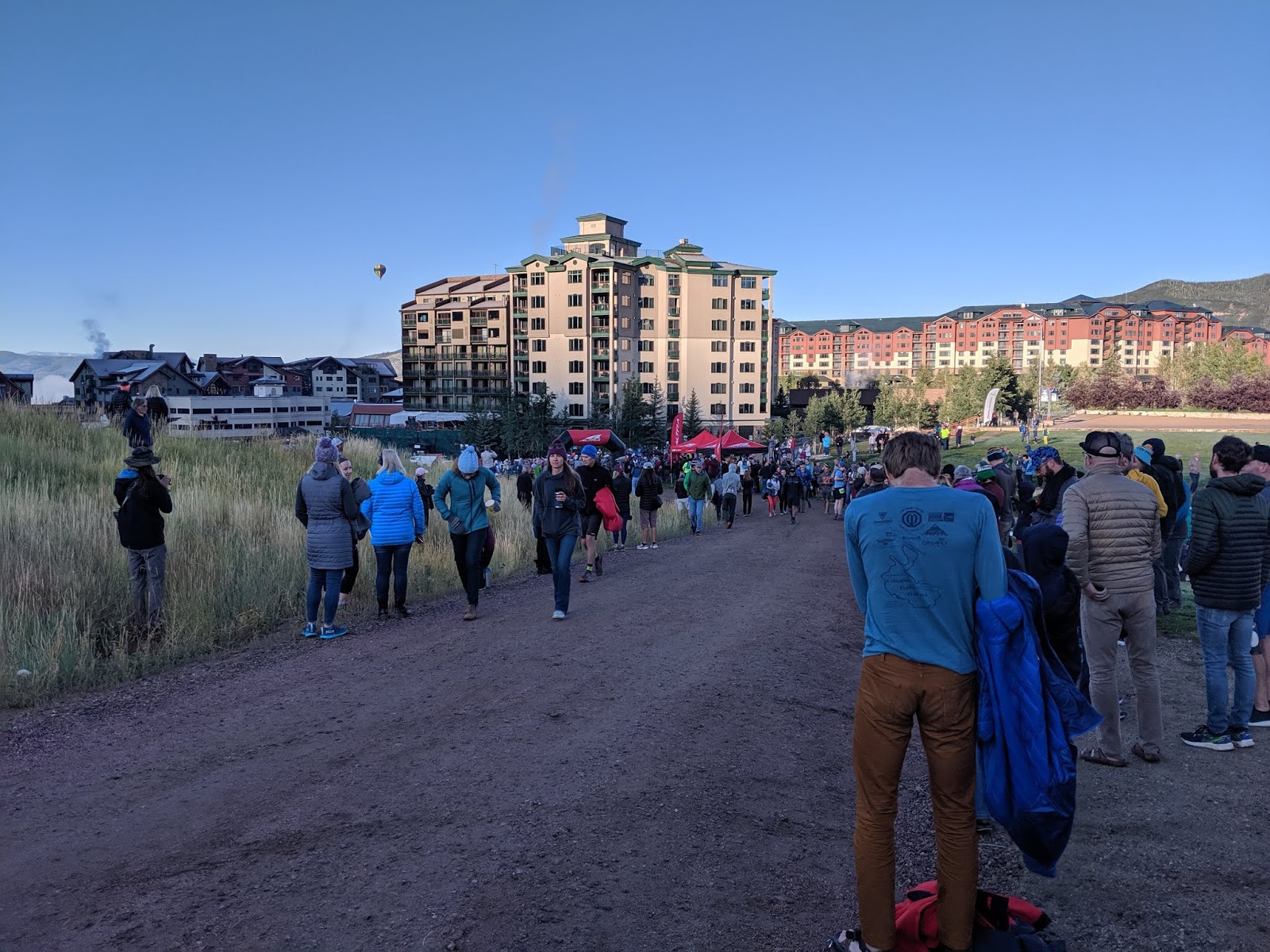
September 13, Friday.  Morning was pretty cold so we got all bundled up at the start.  Walking up to the start we met a runner named Bryant from Golden, running his first 100, with his sister crewing him.


Staying warm at the start

We are all lined up behind the banner
I intentionally started in the back of the pack.  Knowing the first climb is 3,500 ft in 5 miles, I really did not want to blow up this early in the race.  We stayed in the single track trail for a bit, then spread out wider on the ski slope under the gondola going straight up.  At this point I think there were only 10 runners behind me.  I was climbing near a girl all bundled up, and I learned later she's from Mississippi and will eventually finish the race!

After the gondola section, the course moved to the fire road switchbacks to the top.  Here I was still walking easily, and started passing people including the southern girl.  I think the altitude was starting to get to some people.  I was very glad for all those high elevation outings, which made this elevation easy.

By Mt. Warner Aid Station at mile 5, I had passed perhaps 15 runners and arrived at 1:50 on the clock.  A quick two minutes stop to fill the bottles with water and tailwind, and some bite of food, and off I went.  The next 7 miles are beautiful runnable trails trending down to Long Lake.  I continued to pass people while running easily,

Trail just beyond Mt. Warner Aid Station.
I arrived at Long Lake Aid Station at 3:30 on the clock, about 12 minutes ahead of the planned split which was based on a 33 hours finish extrapolated from last year's winner's splits (he ran a very even effort race).  Another quick 2 minutes stop and I was off running down toward Fish Creek.  I have heard things about this section.  However the first three miles were lovely smooth trails gradually dropping down.  Here I ran into a couple guys from Bend, Oregon and the three of us stuck together for the next 3.5 miles chatting and laughing through some super gnarly rock gardens that's the heart of Fish Creek drainage.

Fish Creek trail
Arrived at Fish Creek Aid Station around mile 19 at 5:07, still 12 minutes ahead of the plan.  I leaned my hiking poles against the food table so I can use both hands to eat, and within a minute, my poles disappeared.  I asked the volunteers if they had seen it, and one of them said she saw a tall skinny runner took it and went back up the trail already.  Great, tall and skinny described about 87.5% of the runners here.  She also said he had a green shirt and yellow hydration pack and she handed me another set of poles thinking these may be his.  After stuffing myself with more food, I took off down the trail (up the trail actually) hoping I would catch the guy.  Catch him I did, about two miles later.  He apologized and it was totally unintentional and he was feeling a bit out of it.  We stayed together for the next mile chatting then he fell back leaving me alone again.  I climbed back up Fish Creek still feeling fresh and energized, at an easy effort.  The last two miles before Long Lake Aid Station, I started seeing the Hares coming down, including Jonathan and Tim and I said hi to them.

Second time back at Fish Creek Aid Station at mile 25.4 and 7:19 on the clock, 24 minutes ahead of the plan.  I guess I actually picked up the pace somewhat.  The stop here took longer, about 7 minutes.  I made sure I ate plenty of food, and I also drank about a liter of water in the aid station since I was somewhat thirsty from the heat down low in Fish Creek.  The next section to Summit Lake will be 8.2 miles and I wanted to be ready for it.

Fortunately, those 8.2 miles are fairly gentle, nice rolling trails.  I eventually caught up to a group of runners and stayed near them without talking, and finally passed them shortly before the aid station.  This section was super enjoyable, with nice open meadows, and views of the Never Summer Range to the east.  Arrived at Summit Lake Aid Station at mile 33.75 and 9:31 on the clock, 47 minutes ahead of the plan, but haven't worked hard at all so I wasn't too concerned.

Summit Lake is a major aid station and I had most of my gear stashed in the drop bag here.  The race requires everyone to leave here with headlamp (I called it the Dionne rule).  Sunset was about 2 hours away, and the next drop bag for the un-crewed runners was 22 miles distant at Olympian.  Fortunately for me, Jade planned to meet me at Dry Lake which was 14 miles away.  I changed from t-shirt to a long sleeve shirt, stuffed the down vest in my pack and wrapped the jacket around my waist, added headlamp and waistlight, and stuffed a lot food down my stomach, soup, mashed potatoes, bacon, watermelon, chips, quesadilla.  I ate enough that I had to walk down hill for a few minutes after leaving the aid station, digesting the food before started running.

An easy four miles of rolling trails and double track roads got me to Billy's Rabbit Hole Aid Station at 10:44 on the clock, 6:44 pm.  Now 50 minutes ahead of the plan.  Billy sent us down Flash of Gold and promised we would enjoy the beautiful sunset, and enjoy the sunset we did.  It was gorgeous, and our timing was perfect.

Flash of Gold

Sunset over the Steamboat Springs valley, viewed from Flash of Gold

A couple running ahead of me on Flash of Gold, bathed by the sunset
When it got dark, I turned on my two lights and ran pretty much at the same pace.  These two lights together produced 780 lumens and gave me great depth perception, making running at night not much slower than running during the day.  Soon I came across a darkened runner trying to change battery in his headlamp.  I used my headlamp to assist him then we ran together the next 5 miles down Flash of Gold, him following my "High Beam".  I learned his name is Evan of Medford Oregon and running his fifth 100 miler.  We chatted non stop for the next hour, passing quite a few runners that were forced to walk due to dim headlamps.  Shortly before Dry Lake, Evan backed off the pace and I ran alone the next 3/4 miles to Dry Lake Aid Station, 48.5 miles in, and 13:13 on the race clock, 9:13 pm and a whopping 77 minutes ahead of the planned split.

Dry Lake Aid Station was a shock to the senses after the sensory deprivation of night running.  Lights and people were everywhere.  Fortunately Jade found me just before the timing table and helped me with food and checking in.  I was feeling great, not cold and very comfortable so I didn't stop long.  After a few minutes, she sent me off down Spring Creek trail with plan to meet me at Olympian in 6.5 miles.

Dry Lake Aid Station with Jade

Leaving Dry Lake Aid Station
The first three miles down Spring Creek were all smooth down hills and I rolled through them pretty swiftly, still not feeling like working remotely hard.  Passed a few runners in this section.  Then the trail comes out to a flat dirt road, and for the first time in the race, I suddenly felt the lack of desire for locomotion.  Nothing that urgently concerned me but the pace was quickly slowing down despite the easy running surface.  By the time I crossed downtown into Olympian Aid Station, I was definitely not as happy as earlier.  Arrived at Olympian Aid Station, mile 55.5, at 14:56 on the race clock, 10:56 pm and 90 minutes ahead of the plan.

Jade took me inside the aid station building where it's warm with tons of food and chairs.  I didn't find food appetizing but forced myself to eat some.  She also convinced me to put on my running pants since the next section will be 14 miles with temperature dropping.  Changing socks along with pants, we discovered the outside heels of both feet had a small blister.  Draining and taping them took some time and I finally was ready to leave the aid station a bit stiff and not feeling the best.  This pit stop took 34 minutes!

I started shivering immediately so I put on the jacket and buff and started the climb up Emerald Mountain toward the Lane of Pain Aid Station.  Right away I knew something was wrong.  Every step became labor and soon I was gasping for air, despite the thick air of low elevation and gentle grade of the dirt road.  I struggled all the way to Lane of Pain Aid Station at mile 58.9 , at 16:39 on the race clock.  These 3.4 miles and 1500 ft of climbing took me almost 70 minutes and it was god awful.  A few people passed me in this section, and I was surprised more didn't.

I couldn't stomach much food at Lane of Pain, so just filled my bottles with water and tailwind.  The next section was a 4 mile loop that loops back to Lane of Pain.  Over the next 2 miles, it felt like someone was passing me every minute.  It simply took all the energy I had to just walk slowly.

Walking slowly gave me time to look into my self.  Jeez, this really sucks.  I wondered what happened to my body.  The lack of appetite gave me an idea.  Maybe I needed to shed some weight down there.  But it wasn't easy to find a spot in the dense bushes and finally I was able to find a tiny opening with a small tree that I could hang onto while squatted.  The spot wasn't far from the trail so every time another light came through I had to be super quiet.  The few minutes of squatting set my legs and feet on fire for sure.

Miracle!  Feel much better and started moving with some authority again.  The next mile and half back to Lane of Pain, I didn't get passed, woohoo!  I got back to Lane of Pain, mile 62.6, at 18:03 on the race clock, 2:03 am.

My plan called for changing the waist light battery at this time.  After a few minutes of fumbling with the new battery and couldn't get it to work, I gave up.  The next section was called Morning Glory, basically 6 miles of endless switchbacks to Olympian.  Even though my GI felt better, I somehow couldn't run faster than 15 min/m pace on gentle smooth downhill trails, my hips were getting sore and tight and prevented me from opening up the stride.

I came into Olympian Aid Station for the second time, at mile 68.5 and 19:50 on the race clock, 3:50 am.  I told Jade I wasn't feeling good but need to eat and get moving.  Inside the aid station I found Jonathan sitting on a chair, dropping from the race.  I was sad for him, he's such a good runner having just ran Leadville in under 24 hours.  I had a flash of thought that dropping would be nice right now but I quickly shoved it away.  G/I was acting up again so I visited a nice warm restroom in the building and took my sweet time there.  This stop costed 30 minutes but it was good to build myself back up again.  Jade also figured out how to change the battery in both of my lights so once again I was going to be the "High Beam".

I attempted to power hike up Spring Creek trail and it worked initially, hips were a bit looser and I was able to pass 5 or 6 runners in the flat section.  After entering into single track trail, I didn't seen another soul and my hips got tighter and tighter and I got colder and colder, despite cinching the hoodie of the jacket around the hat and buff.  Finally topping out on the climb, and with a dawn approaching, I turned off the lights and shuffled into Dry Lake Aid Station for my final time with Jade.  Mile 75.8, time 22:40 (6:40 am).

Dawn approaching Dry Lake Aid Station

Me bundled up, approaching Dry Lake, so happy to see Jade
Jade setup up next to the food table and one of the super awesome volunteers brought me warm soup which made me cry.  I guess at least once during a 100, I needed to get emotional.  Jade also helped me take off the running pants and change into a fresh pair of socks.  The tape on the blisters were a mess but the blisters weren't getting any worse so I decided to do away with the tapes.  Mentally I was fairly bad here, mixing mumbling and perhaps a bit of sobbing.  After 18 minutes of Jade tending me, ready or not, I headed out of Dry Lake aid station in a grandma shuffle.


Leaving Dry Lake Aid Station
The section from Dry Lake to Billy's Rabbit Hole was called Grouse Mountain and super gnarly, climbing 2000 ft in 3 miles over mostly rocks.  But the first 2 miles were flat.  I discovered my hips were worse than ever.  The best shuffling effort on flat smooth trail lead to about 17:45 min/m pace and I couldn't sustain that for more than a few minutes before slowing down.  The pain from each step was excruciating.  To add to the insult, my feet and ankles joined the pain cave, perhaps from sitting too long at Dry Lake.  I watched with envy as group after group of runners passed me with their happy pacers.

I also lost my sunglasses somewhere along this section, which furthered the misery.  Not exactly sure the pace I managed at Grouse Mountain section but it couldn't be much faster than 40 min/m.  It took almost two and half hours to cover the 5.8 miles to Billy's Rabbit Hole and I arrived there at 25:25 on the race clock, 9:25 am, mile 81.9, shuffling slower than a grandma.

I wanted to cry, and to dig a hole to crawl in.  I sat with my face in my hands for a bit to recollect myself, then got to the business of doing what I could to continue to move on.  I forced myself to eat, and asked if any of the volunteers had a spare sunglasses.  No one had a pair.  Then Billy went to his truck and came back with this pair of gorgeous (and I assumed super expensive) shade.  He told me to use them and gave them to Fred (one of the race directors) at the finish line.  Later one I found out these were his wife's!  Billy is an awesome dude!

My stop was fairly quick, about 7 minutes.  I learned to not stop for long enough to let my feet and ankles to get stiff.  Both feet and ankles were happier now but the hips were angrier than ever.  By the time I made to the last mile of flat dirt road before Summit Lake Aid Station, I couldn't maintain even a 20 min/m pace anymore while gasping for breath with each step.

Pulled into Summit Lake Aid Station for the second time, 86.1 miles, 27 hours flat, 11 am.  9 hours left in the race.

I changed the shirt from my drop bag, and one of the volunteers filled my water bottles.  Then I heard another runner call his name, and realized the volunteer was the famous Speedgoat!  Despite my misery, I had to get a picture with him, the man with more 100 miles wins than anyone, and one time the FKT holder of the Appalachian Trail.

Karl the Speedgoat, at Summit Lake
The other runner that was talking to Karl was having trouble with his legs.  Karl's first suggestion was to walk, since there were 9 hours left and we were 21 miles from the finish, enough time to even limp in.  I was in the same shoes and I said I planned to limp in regardless how I felt.  Then Karl suggested to that runner some ibuprofen may help.

Ibuprofen!!!!!

Ibuprofen had saved my first 100 miles race at Umstead.  I took way too much Vitamin I there but I also started the race injured so didn't have a choice.  I had some ibuprofen in my pack.  Why didn't I think to try it?  Other than acute kidney injury which was unlikely since I was hydrating very well and really not exerting myself that much, what could I lose from trying some ibuprofen?  Perhaps they should take away my pharmacist's license for not consider it.

I took two 200 mg tablets as I left the aid station.  A young female runner and her pacer left with me, both were super happy and excited, with the racer running very well.  Soon after the initial climb to the high point of the race, they left me behind to limp alone.

Twenty minutes later I glanced at my watch and saw it showed 17:40 min/m pace.  I haven't seen a sub 20 pace in over 5 hours!  Was the ibuprofen working?  Twenty more minutes go by and I started to jogging slowly, then a bit faster, then power hiking at 16 min pace, followed by more jogging.  Hips were loosening up and breathing was normalizing again.  Hallelujah!!!

By 4 miles into this stretch, I had passed a few runners and felt good and happy to be running again.  The day was sunny warm and my spirit was rising every minute.  By the time I hit the four way junction about one mile before Long Lake, I was running strong and without much effort again.

It was here that I had my first hallucination episode while running, ever.

I saw a bob cat in the bushes, playing hide and seek with me.  The bob cat's head was a strange mix of cat and owl which I thought was strange.  As I got closer, the kitty disappeared.  A few minute later I saw a girl, perhaps 10 years old, praying in the woods.  This was pretty weird, we were miles and miles from the nearest road.  Then quite a few tree stumps became dogs that barked at me.  Then, just like that, no more hallucinations.

Arrived at Long Lake for the third and final time, 94.6 miles, 29:37 on the race clock, 1:37 pm.

A bunch runners were congregated at Long Lake, most were pretty jovial.  The climbs were mostly behind us.  Ahead we had 7 miles to Mt. Warner which included about 800 ft down and 1200 ft up, chump changes compared to what we had done, then the soul/bone/muscle crushing descent down the ski resort to the finish.

Here I saw Tim again.  He started as a hare four hours after us tortoises, and after nearly 26 hours of running, he had caught up to me.

The initial miles after Long Lake were nice, and I still felt strong.  But by the time I was near the end of the climb to Mt. Warner I could feel myself slowing down a bit.  I had also took two more ibuprofen in preparation for the big downhill finish.  As soon as I saw the valley below us, I turned my phone off airplane mode and texted Jade, then quickly received a reply that she just passed Mt. Warner Aid Station and is going to pace me in!!!  She had climbed 3500 ft in 6 miles in order to do this!!

While climbing Mt. Warner, Jade had her own celebrity run in.  Jim Walmsley passed her going up the fire road, running about 9 min/m pace at a 10% grade, holy moly!


Jim Walmsley running up Warner
Jade saw me about half mile out from Warner Aid Station.  I was super happy and excited to see her and put on my best effort to run, which must have looked pretty funny to her.

Jade's first glimpse of me since Dry Lake, 25 miles ago

So happy!!!

I try to run into Mt. Warner aid station, my running looked like slow walking

Resupply at Mt. Warner aid station
Mt. Werner Aid Station: 31:56. Jade was originally worried that she may slow me down on this section.  I assured her that there was absolutely no way I could remotely keep up with her.  My word is stronger than oak!

Starting the 3,500 feet descent into Steamboat Springs and finish line

Fire road descent
I counted the elevation descended, and elevation to go, while alternating between running slowly and walking trying not to induce more pain in my quads and knees.  The last section of single track was fortunately not too long or too steep and finally I was on the last long straight dirt road into the finish.  Jade ran ahead of me and took a video of me running in, and I managed to not to fall head first into the creek to the finish line and gave the mandatory hug to the Bunny!

Finish time: 33:47:04.  Mileage: who knows.  Watch said 108.2.  It's probably reading long.


Jade had her second celebrity moment with Courtney Dauwalter

Hanging out at the finish line

Me, Bryant and his sister/crew.  Bryant dropped at mile 75 at Dry Lake.  I was surprisingly awake despite two beers.


Wednesday, June 6, 2018

Five Tener's Tour: Tenney Crags, Mt. Arthur, Mt. Garfield, Tuckaway Mountain, Cameron Cone.

I can’t remember where I first heard about the five 10k ft peaks between Bear Creek and Ruxton Creek: Tenney Crags, Mt. Arthur, Mt. Garfield, Tuckaway Mountain, and Cameron Cone that's between Colorado Springs and Manitou Springs. It may have been the Nolan’s 14 Facebook. For the past year I periodically studied the topo map to try to figure out the easiest way to do this. One way involve starting at High Drive/Lower Gold Camp road trailhead, do a big loop through Jones Park then descending Cameron Cone the standard route into Manitou Springs then back over Intermann trail. That seems to be really long. Plus I have never done Cameron Cone’s standard route and will have to do that first to check it. Finally I decided on an sort of out and back route from Seven Bridges trailhead that’s significantly shorter but have a bit more bushwacking then the big loop route. Part of the research was based on a trip report found here from 2008 from KentonB on Tenney Crags, Arthur and Garfield. Another source was a GPS track from Alyson Kirk (the lady who did all 12ers, 13ers and 14ers in Colorado) from Garfield to Tuckaway on LoJ website.

I did part of it on December 31st last year, hitting Arthur, Garfield, and Tuckaway in a day. It wasn’t bad except from Garfield to Tuckaway which took almost two hours. The flat saddles between Garfield and Tuckaway were amazingly difficult to navigate since there are no far reaching views to help nail down directions. I also stepped on what I thought maybe a bear hibernating den which scared the crap out of me. The 12 miles trip took 6 hours.

I had my mind set on this past weekend to get this done. With family out of town, I have no obligations and have all weekend to myself so I can be totally lazy on Sunday. Leaving Seven Bridges parking at around 7 am, I made it to the Jones Park trail split at 8 am, then took the old decommissioned 667 trail north for a bit to find Tenney Crags trailhead. About ¾ way up that trail, it started turning away from the summit. I got a bit suspicious and figured it may not be going to the summit after all or taking a long way, so I turned left off the trail. It was a mistake. Scrambling along boulders and down trees and bushes for 10 minutes and I end up rejoining the cairn marked path again. I climbed what I thought was the summit only to find a higher crag just east of it. End up on the true summit a few minutes later around 9:15 AM. The view was pretty cool, and I can see Mt. Arthur to the west and Cameron Cone to the northwest. I stopped for about 10 minutes to admire the view and eat a bit of beef jerky, granola bar and chocolate covered almond.

Mt. Arthur in the left center, seems higher than Mt. Garfield to its left but that's due to Garfield is a bit further back.  Cameron Cone is teasing on the right.  
The first part after leaving Tenney Crags was nice. Flat saddle that was mostly wide open with a few
campsites here and there. Then the trees and bushes and rock appeared and it wasn’t so easy anymore. I took multiple bearings with the compass and occasionally checked the GaiaGPS app to make sure I’m still heading the correct way. I came up Mt. Arthur from the southeast side and there were some cool crags that required all hands on climbing. Made to the summit on Arthur at around 10:30 AM. I didn’t stay on the summit at all, knowing Garfield is close. Descending Arthur I weaved a bit too far to the south and had to regain the saddle and the clearing. I remember from the last trip climbing directly to Garfield summit was steep, so I aimed for the north side of the summit and sure enough there were some cairns there. The route was much easier this way and I met another hiker on the summit at around 11 AM. We chatted a bit and he went back down while I enjoyed my second snack consisted of PBJ and delicious water. Beer would have been even more delicious! The weather was perfect with blue sky and almost no wind at all.

I remembered that descending the northwest ridge of Garfield was a pain and there were some rocky
points that I bypassed on the east side in steep talus fields. This time I stay on the west side of the
points and though steep it wasn’t nearly as unstable as the talus on the east side. After the saddle, I
veered further north before climbing the first part of Tuckaway and found it wasn’t any easier than the direct path. On the final climb of Tuckaway I once again found some cairns that marked a fairly open path to the summit which I arrived around 12:30 PM. On my first trip here back in December I searched but couldn’t find the USGS marker or summit register. This time I didn’t bother since I had a long way to go. I did once again enjoyed a snack of my remaining beef jerkies and almond. The view from the top was pretty good, especially from the south end of the summit ridge where I had a great view of Jones Park and my eventual path down. Cameron Cone looked amazingly far from here.

From summit of Tuckaway Mt. looking at Cameron Cone.  It's only about 2 miles away but so many trees between here and there.  
Tuckaway Mt. summit had a nice view of Jones Park.  Mt. Garfield is on the left.


I had mapped out two paths to Cameron Cone. The low route descend north from a saddle at 10,500 ft down a drainage and crosses Willow Creek just above where it drains into Big Tooth Reservoir, then climb east up the west ridge of Cameron Cone. The advantage of this route is I can refill water from either Willow Creek or the reservoir if the creek is dry. However this route go down to 9400 ft. The high route go from the saddle between Tuckaway and Garfield, and curves around the ridge that’s between Garfield and Cameron Cone at 10,000 ft. It also crosses Willow Creek but near its source so there is a chance it is dry.

I checked my water and saw I still had a good bit left in the bladder so I decided to save my legs from the extra climbing and take the high route. Coming down Tuckaway toward the saddle I decided to try another way, heading directly east over a small hump and I think this turned out to be the easiest way to the saddle at 10,150 ft. Next time I will take this way for sure. I got confused for a while trying to follow the contour of the ridge then eventually found the way and crossed Willow Creek which was pretty much a trickle. Initially I was making good progress, the terrain fairly open. As I got closer to the point of the ridge, the slope got steeper and I was mostly scrambling among boulders and dodging downed trees. The progress became painfully slow before I finally made to the saddle south of Cameron Cone.  From there, it was a fairly straight forward climbing the southern slope to the summit. Though I did get too close to the south ridge and climbed some crags that I was able to avoid on the way back down.Made to the summit at around 2:15 PM. The summit wasn’t what I had imagined, it was fairly long. I somehow thought it would more of a point. I found a nice shady spot on the east side and ate my sandwich with a great view of the city below, with Tenney Crags, Arthur and Garfield to the south.

Tenney Crags, Mt. Arthur and Mt. Garfield all lined up for this photo, but Mt. Rosa photobombed it.  
At this point I turned my phone’s airplane mode off to update my wife and immediately received a
bunch texts from my wife and my co-worker looking for me. Turned out some urgent crap had come up at work and I may be needed that day. I texted my co-worker back that I would get on it as soon as I get back to my car. Well, nothing I can do about it at that moment.

As soon as I stepped off the summit, I realized I was out of water. Turned out some of the stuff in the
hydration pack was pushing the bladder up a bit making it looked like I had more water when I checked earlier. Coming back following the 10,000 ft contour line was even slower on tired legs and finally I made to Willow Creek. Fairly thirsty now and not thinking clearly, I dipped my mouth into the largest puddle I could find (about the size of my face) and lapped it up like my dog. Later in the evening I realized I could have used my Sawyer Mini filter to drink directly from that puddle. Tired and dehydrated brain doesn’t work that well.

A final steep but short climb over many downed treed took me back to the saddle between Tuckaway
and Garfield. If I ever learned to backpack, this saddle would be a great campsite. A short easy downhill jog from the saddle took me down to Bear Creek. Finally a stream big enough to fill the Sawyer Mini’s 16 oz bladder to filter water. I sat down and happily drank directly from the bladder through the filter three bags worth before satisfy the thirst enough to fill my water bottles. From there it an easy jog down to Seven Bridges trail and back to the car shortly before 5:30 pm.

There I found out the work issue had been resolved!

Total mileage is 17.8. According to my Garmin, net gain is 6,050 ft. My legs feel far more tired
comparing to a round trip to Pikes Peak via Barr Trail. That two and half miles of traversing the 10k
contour to and back from Cameron Cone probably had far more up and downs than the Garmin recorded.

Friday, April 7, 2017

6 years to 100 miles

I have pretty much laid off running ultras since the twins were born in 2013.  I survived the last few in the spring of 2014 and they were all fairly short (MST 50k, Uwharrie 40M) that did not require huge amount of training that would have taken too much time away from the family.  After moving to Colorado Springs in October 2015, this trend continued to the point that I was hardly running races of any distances anymore.  I did continue to participate with my relay team Team Road Kilt in 2015 at Blue Ridge Relay and also in 2016 at Hood 2 Coast.  It was at the finishing line party at Hood 2 Coast where things would change.

I have gotten used to running 6 legs at relay races, but the 2016 Hood 2 Coast race was done as 12 runner team so I only had 3 legs to run.  I took it pretty easy in the summer of 2016, working on projects in our new house such as building fence.  I also did more hiking than running and as August approached I thought about walking the 3 legs.  The relay itself wasn't terribly taxing.  The legs were either flat or gentle rolling even though the scenery were sort a let down after running the Blue Ridge Relay for so many years.  The finishing party however was pretty cool, right on the beach and Bob even waded out into the cold Pacific Ocean for a nice soak.  We were all sitting along the long tables drink beer when Tina said hey are you interested in running the Umstead 50 with me next year.  I was like hmm...not way I could be ready or train for it so I dodged the question saying there is no way Jade will let me do that.  I went back to my beer for a few minutes then Tina said I just texted Jade and she said go ahead.  Oh Crap!

In September in another subconscious attempt to avoid running the race, I tried to register for the race on my phone while fishing in the mountains.  It totally didn't work and I was secretly hoping Tina did not get in the race.  But a few minutes later I got a text from her "I'm in!".  Oh Crap!

I knew there is another way to get in, and now that Tina is in, I'm sort of committed to at least try.  I filled out the volunteer lottery form and send it in.  A couple weeks later I got the confirmation email that I'm in.  Oh Crap!

I had a heart to heart discussion with Jade about the race.  She and I both agreed, that if I'm going to put the training in, and she had to sacrifice with the kids while I run, then I should go for the 100 and get it done this time.  I sat down in front of a calendar and spreadsheet and mapped out a 6 months training schedule.  I may not be much of a runner, but I sure know how to write training plans.

Fortunately for me, the winter of 2016/2017 is rather mild.  We did get a few cold spills in December where I had to run in single digits temperature in the snow but most long runs are in fairly moderate temperature.  I finally stopped goofing around the mountain trails and settled on a training course that  closely approximately the Umstead course.  Rampart Range road climbs gradually but consistently from Garden of the Gods at 300 ft per mile.  It's a wide dirt road that's closed to traffic in the winter.  I would park at the gate, power hike up just past 3 miles for 1,000 ft of elevation gain, then run back down to the car to refuel.  It's about 87.5% steeper than Umstead but provide the same surface, same type of walking and running and same refueling schedule so it'll do.  I did my longest training run in late January, 37 miles in 7 hours and 40 minutes.

Then I got sick, bacterial sinusitis from my kids, that took me out for two weeks and I lost 4 lbs while doing nothing.  Training restarted in middle of February for two weeks, then on February 22nd disaster strike.  

We took the kids to skiing in Loveland where there is an awesome area for kids with magic carpet ride and a super easy chair lift area.  We brought out all the snacks and drinks with us to the bottom of the magic carpet ride.  While taking a break with the kids and sitting on the snow, I twisted around to reach for the backpack to get some food out for them and I felt a sharp pain in the right knee.  I didn't think much of it figured it'll go away, and it did go away and I was able to ski with the kids rest of the day without pain.  Then next day I went for a 13 mile trail run and had a hard time walking that evening.

A week and half later, I still couldn't run more than 10 miles without pain, with downhills bothering it the most.  A long chat with my friend Lauren convinced me to get some PT help.  On my first appointment with the PT on March 10th, she said I partially tore the tendon above the knee, the quadriceps tendon.  Recovery time with rest and PT is usually 6 weeks.  I looked the calendar in the PT's office and counted the weeks: from February 22nd to April 1 is five and half weeks.

My PT is hopefully and started an aggressive therapy plan with massages and acupuncture, and I do stretching and strengthening on my own.  After two weeks, I did a 5 miles run and experienced very little soreness.  With one week to go I did the longest run, 9 miles and again very little soreness on the right knee.  However I have avoided all downhills running so far.  PT and I discussed and agreed that I should start the race, and as long as the pain is manageable I should continue, but stop if the pain is severe enough where I have trouble standing.

I flew to Raleigh on Thursday evening and spent Friday hanging out with my cousin and his family.  Instead of resting and staying off my feet, I chased my two nephews around the house and had a great time.

A lot people asked what my race plan is and what time I expect to finish.  With the knee injury, I basically have no idea how the weekend will unfold.

The race weekend's weather is nearly perfect, high in the mid 70's on Saturday and low around 50 Saturday night to Sunday morning.  I rode to the race with Bob and Tina, and Bob will crew for both of us.  Tina had pacers lined up for all 4 laps in the 2nd 50.  I on the other hand only had Sherri lined up for lap 6, and that was Sherri's initiative.  I didn't actively arrange pacers because I didn't want the pressure.

Lap 1: Tina and I started together and we ran most of the minor hills and walked two major hills to AS2.  I kept the pace pretty slow worried that I may drag her along too fast.  She had to visit the porta potty as AS2 and I went on by myself.  I did eat a little bit as AS2 but since they mainly had breakfast type of food I didn't eat much.  The right knee was already making its presence felt and I was getting worried how the race will unfold.  Finished the lap at 2:23 on the clock.  I asked Bob for two ibuprofen tablets and grabbed some food to from AS1 to go.

Tina and I approaching AS2 on Lap 1


Walking up to AS1 at end of lap 1
Lap 2: Ibuprofen didn't kick in for another 40 minutes so the first 3 miles I still felt the knee but between mile 3 and 4, the pain disappeared and I was feeling much better.  Okay, if ibuprofen can keep the pain at bay, maybe I'll have a shot at this.  I kept a good pace on lap 2, running up all the small and gentle hills even on Turkey Creek, and only walked the major hills.  Toward the end of the lap, it was starting to get warm.  I made a mental check list of what I need to do at end of the lap: caffeine, food, water bottle.  Bob again greeted me and walked up to AS1 with me to help me carry some food while we talked about my race and Tina's race.  Jen checked the time and told me to slow down for the next lap and I agreed.  By now AS1 is making real food so I grabbed half a cheeseburger and some mountain dew.  Run time: 4:47, lap 2 took 2:24 which is about the same as lap 1.

Lap 3: I focused on slowing down and it was definitely getting warm.  I did see Tina right at the airport water fountain and noticed her pace was still pretty fast so I told her to slow down.  I noticed a few miles into the lap that the right knee is starting to strain again.  Started doing some mental calculation and decided to take two ibuprofen every 1.5 laps.  This will give me a total 5 doses of 400 mg and total daily dose of 2000 mg.  This is fairly high especially considering the stress I'm putting my kidney through, but I didn't have any other choices.  Still running strong on this lap, I did take a longer stop as AS2 since I felt somewhat queasy right as I arrived as AS2 and thought maybe I need a #2 relieve.  End up with just a lot of gas though.  I didn't get the burger but rather some milder food as AS2 with ginger ale to sooth the stomach.  Still ran up some hills but this lap is a good bit slower due to the heat.  Finished the lap and once again chatting with Bob as AS1 while I grabbed a burger and dew.  Run time: 7:24, lap 3 took 2:37.  I assured Jen that I was slowing down and she said just be careful with the heat.  

Lap 4: once again the focus is to stay slow.  At the airport spur I ran into Lisa, Dottie and Ricky on their bikes, it was very cool to see them and talk to them.  I told them to ride into AS1 to find Tina since she should be finishing lap 3 soon.  I was hoping to see Tina coming up Graylyn as I ran by the intersection but no cigar.  Rest of lap 4 was fairly uneventful and I took my ibuprofen a mile or 2 before I finished the lap.  I had gotten into the habit of eating the cheeseburger out of AS1 and eating a lighter meal out of AS2, mainly little bites of sandwhichs, pbj, and cantaloupes.  By now I had increased my AS1 food intake to a full cheeseburger with ketchup and mustard, and a handful of potato chips and mountain dew with ice.  Told Bob I was feeling food and looking forward to a cooler lap.  Run time: 10:14.  Lap 4 took 2:50.  

Lap 5: the temperature is definitely cooling down and I felt better.  Sticking to the ibuprofen schedule and I noticed that I need to take the dose a couple miles early to keep the effect going.  I ran into Wayne Jones on his bike and he end up riding with me for two miles down Corkscrew and up the Lake hill while we chatted and caught up, it was so nice to see friends in the park.  I ran the next 2 miles with a runner from Denver named Patrick and he told me about Never Summer 100k which has been on my radar for awhile.  Right before AS2, we rounded a bend and woman saw as and screamed in joy.  I asked Patrick if that was his wife and he said he has no idea who she is.  Then I realized it was Kristen!  Awesome.  She and I ran down to AS2 together and she checked on me and we made plan for breakfast on Tuesday.  I lost Patrick so I finished rest of the lap on my own still feeling okay and looking forward to lap 6 and Sherri.  Run time: 13:04, lap 5 took 2:50 which is exactly the same as lap 4!  And bonus: first frappuccino at end of Lap 5!

Lap 6: Sherri started pacing me.  I had her carry my jacket in case I got cold and we both carried headlamps out on this lap.  It's so nice to have someone to talk to for the whole lap and Sherri brought me up to date on her running, her march to DC, and her dog.  I was still feeling good enough to run up some gentle hills by this lap.  It got dark shortly before AS2 so we both put our headlamps on.  Most of lap 6 were pretty good but the right knee is definitely getting more painful despite ibuprofen, and both feet are getting painful, the soles were getting tired of the pounding I guess.  As I finished lap 6, I heard a huge cheer as the timing tent and realized my old neighbor Meredith was there cheering me!  I missed hanging out with them since we moved!  Run time: 16:18, lap 6 took 3:14.  

Meredith and I at end of Lap 6

Lap 7: I had a long stop before lap 7, changing into long pants, adjusting the knee brace, adding a jacket, and generally fumbled around Bob's truck for too long.  I think we stopped for close to 15 to 20 minutes.  Sherri had decided to pace me for lap 7 as well while Bob promised he'll find someone for lap 8 for me.  By now ibuprofen had became fairly useless and both feet were hurting badly that I didn't want to run anymore so we made this lap a pure walking lap.  I really struggled with the knee on the back half on Turkey Creek and decided to take 600 mg of ibuprofen instead of 400, and took it 3 miles before the end of the lap.  At this point, it's time to put everything on the table.  The lap ended slowly.  I still don't know if I had a pacer for lap 8 but I was determined to finish even if I had to go alone.  Sherri wanted to pace again on lap if there was no one else but I really hate to make her do that.  Run time: 20:15, lap 7 took 3:57, way too long.  

Lap 8: Tim showed up super excited to pace me.  Awesome!  Tim is hilariously funny and I knew this is gonna be a good lap.  Another burger and off we went.  Somewhere around mile 4 I decided to pop two more ibuprofen. Jeez, pray the kidneys don't rebel.  The pain in the knee is getting pretty bad and I cuss a lot of things.  The pain in the feet is also getting pretty bad and more cussing ensues.  Tim tells me all sorts of funny things, and the stripper joke just about landed me on my face and definitely took my attention away from the pain for awhile.  Tim also kept watching my pace and kept me informed that I'm averaging very consistently 16:30 to 17 min paces.  By the time we hit north Turkey Creek I was feeling somewhat confident that I may just finish this thing under 24 hours.  After we hit the bottom of Powerline hill, the reality hits that I'll get this done.  Only three uphills and one short downhill at end stand between me and the finish.  We put on cruise mode and by the time we made the turn at airport water fountain, I was getting a bit of teary.  Finally we get to Bob's truck and Tim was trying to find them but I wasn't about to stop.  I fairly flew up the last little hill and into the finishing line at 23 hours, 49 minutes and 15 seconds!  


Sherri and Tim with me at the finish
It took 6 years, but I finally completed 100 miles!


Saturday, March 12, 2016

Pikes Peak Marathon

I first learned about Pikes Peak Marathon when I was researching about Umstead Trail Marathon's elevation profile in 2010 and came across Anthony's popular post that compared some famous marathons to Umstead.  Ever since then I had wondered about the prospect of running a marathon on Pikes Peak.  I have read Matt Carpenter's website with course description and other tidbits that he posted there.  Since Matt owns the PPM's course record and is generally considered Mr. PPM, the advice he suggested are second to none, such as this one "Oxygen is overrated, keep running!".

Once I found out I was moving to Colorado Springs, PPM naturally was on my list.  The registration for the 2016 race is at noon on March 12th.  I had booked this date on multiple calendars.   A few days before the registration, I went to the race website and discovered the race cost $175!!!  Holy f--k!  Even Umstead 100 only cost $180 and they provide a 30 hours buffet of Golden Corral style food.  Screw that, I can run this race on my own term and not pay a penny.

So instead of sitting in front of my laptop sweating bullets at noon on March 12, I'll be somewhere on the Barr Trail sweating bullets doing my own PPM.

Weather forecast was good and bad.  Almost no wind on the summit, however there maybe a storm in the afternoon.  Now a storm on a 14er summit is no joke.  No one wants to experience it.  So this means an early start and get back down in the trees by noon or 1.

Before this I had gone up Barr Trail as far as 2.5 miles from the summit.  That was not a bad run, took a leisurely 6.5 hours to do.  I even ate lunch at 12,300 ft turn around enjoying the sun.  Today would be different.  I had gone up two other easy 14er's in the past two weekends so I was hoping I'm a bit more acclimatized.

5 AM and I hit the road from Memorial Park in Manitou Springs.  I could have parked at the Barr Trail's trail head but didn't for two reasons.  PPM actually starts at Memorial Park, and the trail head parking cost $10.  I'm a dirtbag.

1.3 miles and a couple hundred feet later, I hit Barr Trail.  I usually come here later in the morning when the trail is full of people who did the Incline and coming down on Barr Trail.  However at 5:20 AM, there wasn't a soul on the trail!!  Yeehaa!  The first 3 miles of the trail is one of the steepest sections, called the W since that's what it looks like on the map.  It has 13 switchbacks and gains 690 ft per mile for 3 miles which is 13% grade.  I remember I used to bitch about the 6% grade on Powerline hill in Umstead or the the 8% grade on Cemetery hill.  Knowing this is gonna be a long day, I take it easy here.  For the first time in Colorado I wore my heart rate monitor and it's a great tool to manage the effort.

First glow of sunrise

Glow over Colorado Springs

Alpine glow on the east face of Pikes Peak where I'll eventually be having fun


After the W's I see snow and ice on the trail so I put on the Microspikes.  These things are awesome for running in snow ice and slush.   Today the trail condition is mixed between mile 4 to 7 with alternating dry trails and snow.  Still it's a good tool.

I hit Barr Camp at mile 7.5 and 10,150 ft in 2:42, which is actually one of the faster efforts surprisingly.  Stopping is out of the question since once hot chocolate and coffee is served, I usually stay for an hour or more digging the caretaker Zach's brain.  Zach is twice the runner that I'm.  No he's not twice as big, but twice as fast.  He recently won CCC and TNF 50 championship.  I did fill my water bottle with some unfiltered stream water at Barr Camp.  Giardia takes 7 takes to show symptoms, won't affect today.  Barr Camp is considered the half way point to the summit both in elevation gained and time spent.

From Barr Camp, the trial became completely covered in snow.  Fortunately there has been enough traffic to create a hard packed snow trench that's between 8 to 12 inches wide.  However any steps off this hard packed stuff results in serious postholing, not fun and can easily pull the groin muscle.  It's not much of an issue going up due to my glacial ascending speed.  But running downhill with speed on this stuff, it is easy to go off and posthole.  It takes me 27 minutes to get to the next landmark called Bottomless Pit sign at 8.75 miles and 10,800 ft elevation.  The real Bottomless Pit is another couple miles to the right.  A day may come where I head right to the Pit, but not today.

15 more switchbacks in the snow led to the A-Frame at exactly 4 hours.  A-Frame is at 11,950 ft at just over 10 miles.  People actually shelter here.  It's right below the treeline.  This is fast!  Three weeks ago I got to A-Frame in 4:15.  Those two trips up 14ers must be helping.

From A-Frame I ascend above the trees and into the barren east face of Pikes Peak.


Trail here is mixed of dry trail and wind blown snow.  It hasn't snowed much in three weeks so what I saw here are mostly left over and deposited by wind.  After 35 minutes of zigzagging I come to the 2 miles to go sign on the right side of the east face.  From here the trail basically traverses all the way across the face to the left side.  Here I encounter something I never imagined.  The trail goes under a perfectly smooth about 25-30 degree sloped snowfield.  Obvious the work of wind.  Apparently no one else has crossed it so there were no tracks on the slope.  My Microspikes are great running on even snow, but this is more crampons/ice axe territory.  I imitate the mountaineers I see on TV by kicking the slope to make steps.  But after a few kicks the only thing I did was to make my toes hurt.  I guess you need big boots and crampons for that.  Then I did the next best thing, got down to my hands and crab walk across.  Yeah not pretty, and pretty scary too.  A slide means hmmm.....bad.  After I make across the snowfield, I find another one a few hundred feet later.  Crap...crab walk again.

After the excitement of the snowfields, the traverse was pretty uneventful except for my breathing which was somewhat out of control from the combination of exertion of the crab walk and fear of death.  I get to the next land mark the Cirque sign which is just before the 1 mile to go sign.  I didn't know what the Cirque sign meant "1500 ft deep".  The I walked to the edge of the trail and saw it.  Yes, it does look like a 1500 ft straight drop.  I guess is someone is really struggling during the race, they can end the suffering right here by going off the trail into the beyond.


Cirque
Grand Traverse


The trail next traverse back toward the right with some switchbacks that has deep snows on the trail but no snow at all off the trail.  Go figures.  Then comes most infamous sign of all, the 16 Golden Stairs.  This is suppose to be 16 pairs of switchbacks with huge boulder to climb over at each one of them.  I tried and lost count, since I spent most of the my time here hugging the boulders dizzying from lack of oxygen and trying not to tumble over the edge.
Final traverse toward the base of the 16 Golden Stairs

Summit of Pikes Peak was somewhat anticlimactic.  There was a cog train waiting to go down and a lot tourists walking around.  I didn't stop long just enough time to eat my nutella-jelly sandwhich (I ran out of peanut butter).

Going down, I was determined to avoid those damned snowfields.  On the grand left to right traverse, I picked a gentle looking spot and got off the trail.  I took a bearing toward a set of huge boulder formations at 12,500 ft and went straight for it with three big horn sheep watching me from not 50 yards away.  Unfortunately I should have scouted the route a bit more carefully.  I end up on more snowfields on this new route, not as steep or as exposed but just as tedious.  I remembered seeing people on other peaks doing this thing called glissade where they slide down snowfields with ease and descent with little effort and a lot of speed.  I decided to give it a try.

Turned out I don't know how to slow down.  I glissaded right out of the snowfield into a scree field. At least I missed the boulder field since that could have ruined the day. This is my first time ever experiencing scree.  They don't stay in one place, they actually move a lot, like an avalanche sort of way.  And they get inside of everything including shoes and pants.  Pulling scree out of my underwear is now my newest trail running trick.

Here is my route on the ascent and descent of the east face.


Rest of the run was uneventful.  I apparently can not navigate the trail around A-Frame.  For the second time in the row, I took a different way down past A-Frame.  I don't know how that happened.

Ascent took 6 hours and 6 minutes, descent took 3 hours and 22 minutes.  And I did stop at Barr Camp on the descent for a cup of hot chocolate.

Pretty views from the summit.


Tuesday, August 13, 2013

Annihilation

I originally planned to drive up to Morganton and camp at Mark's house Friday night, since Mark lived only 10 minutes from South Mountain State Park.  However Jade's last minute consignment shopping means I get to stay home with the babies on Friday night.  So I woke up at 2:30am on Saturday morning and left the house at 3:30 am for the three and half hour drive to the race.

Somewhere near Burlington, I realized I had left my wallet back at home.  My car was down to a quarter tank at this point.  I could turn around and go home but that means I would start late, way late, like and hour and half late.  I went to a gas station and started talking to the gas station manager about options.  I told him I knew my credit card number, but he was pretty iffy about that without any kind of photo ID.  Finally it dawned on me that I may have send a scanned photo of my driver's license to someone in the past so I started searching on my phone for past emails and hallelujah, a scan of my driver's license and my credit card!  He saw that scan and finally decided that I was likely not a credit card thief.

Pulling into South Mountain State Park at 7 am, I noticed all the towering ridges around me.  It seems like the road leading into the park followed the bottom of a steep valley.  The impression I got is every trail here goes UP.  As I collect my race packet and get my hydration pack ready, I looked around and realized everyone I see seemed really fit.  Seriously this is the fittest group of runners I have ever seen at started of a race.  Every one is lean, and every one is ripped.  It made me really question why I'm even here.  I don't belong to this group!  I'm a slow plodder, and everyone around me seemed capable of running in circles around me.

Race briefing
Bigfoot!  We tag his head to finish. 
We started with a bull horn blast and ran across the parking lot and I intentionally settled into the very back of the pack of 50 runners.  The trail immediately starts to climb and I settle with the back of the pack into a power hike.  The race is divided into five sections, Alpha, Bravo, Charlie, Delta and Echo.  Alpha section is just under 6 miles, with the first 4 miles climbing on a rugged steep jeep road, then the course drops off the side of the mountain on a steep technical single tracks dotted with slippery steps.  Here I met Kathy from OBX, where the biggest hill is the Wrights Brother memorial mound, and she pulled away from me while bombing down the mountain.  How in the heck did she train for this?

Alpha section: 5.65 miles, 1,700' gain, 1,700' loss, 1 hour and 20 minutes.

At AS1, my legs were a bit wobbly from pounding down the mountain.  After refilling my pack, I took off down Bravo section with three other runners in a loose pack.  The first mile and half were fairly mild with only 300' of elevation gain and two cool creek crossings.  Then it turned upward in a mad 30% grade along an ridge line.  Here I manage to let everyone get ahead of me, since it was useless try to keep up.  Fortunately the madness was short, not even a quarter mile but climbed over 450'.  Then the course emerged onto a decent jeep road and gently climbed to 2'600 ft before a long quad pound descent back to the same aid station.  By now my legs were ready for a massage, with quads and IT bands screaming on the downhills and hips and calves screaming on the uphills.


First creek crossing

Still happy since I didn't know about the climbing ahead of me.
Rachel pulling ahead on the 30% grade single track trail around mile 7.5
The view on the top is gorgeous but we didn't get to see much of it
Another creek crossing on a log bridge
Creek crossing near end of Bravo section.  
 Bravo section: 8.52 miles, 3,000' gain, 3,000' loss.  2 hours and 15 minutes.

The friendly volunteer at AS2 promised less hill for Charlie section.  He was right, at least for the first 1/2 mile.  Then we hit the waterfall part, where a section of super steep stairs climbed to the top of the falls.  My strategy for the stairs was to do 10 steps, then rest, then repeat.

Trail just before the waterfall
Crossing the base of the fall
Dreaded stairs, which climbed straight up for 350 ft.
Charlie wasn't done after the waterfall yet.  I met a runner named Wayne from Georgia and we climbed more moderated grade jeep trails (like 15%) for awhile, then dropped off along a single track into a cool creek valley before climbing steeply away from the creek.  Wayne was bothered by leg cramps so he couldn't down hill much so eventually I left him.  I get passed by Jake who had gotten lost and ran extra 9 miles in Bravo section and still manage to pass me by mile 17.  After the long climb along the single track trail, I ran gingerly down a steep jeep trail for a mile to protect the quads from cramping and came across a beautiful creek with a beach along it so I took the opportunity to cool off and laid down in the creek and thoroughly chilled myself.  5 minutes later, I was overheating again because the damn trail decided to climb another 500 ft to the end of Charlie section.

Charlie section:  6.23 miles, 3,250' gain, 2,100' loss, 2 hours.

AS3 is located where the trail pops out onto a private road.  I met a couple in the aid station and they looked as fresh as at the start of the race, and the woman is wearing a pair of sandals!  I couldn't imagine how she could run these trails in them.  Delta section follows the road for about a mile with no shade and it's 1:30 or so in the afternoon, and temperature hovering around 90'.  I was more than happy to see the course re-enter the woods at end of the road and starts down the mountain along a gentle single track.  Normally this kind of trail and terrain would mean fast times, but with quads completely shredded, I could only manage to plod along at a snail pace with occasional walks to relieve the pain in my legs.  Finally the sections comes to an end with a godsend creek crossing to cool off and a short out and back section to AS4.

Delta section: 4.98 miles, 870' gain, 2,100' loss, 1 hours 8 minutes

The fine folks at AS4 promised me there are only two climbs left in Echo section but was vague on the details.  A thunderstorm approached as I took off down the short out and back spur and crossed the road to start the first climb.  Within minutes, the storm came down and the jeep trial became a creek.  On the other hand, I was no longer overheating.  I actually got a bit chilled from the driving wind and rain, and probably from the fear of getting hit by lighting.  Later on I would find out another runner actually saw a lighting splitting a tree no more than 50 yards from him.


20 minutes later, running scared, the storm finally settled into a nice rain.  The trail turns down the mountain along a slippery single track and I caught up to Rachel.  Rachel is also from OBX.  I honestly can't think of a good reason why someone from OBX would choose to run this race.  We stuck together for the next few miles as the trail once again turn skywards toward another long climb.  We marveled how it is possible to cram these many hills in a 50k.  Super relieved to hit the summit, we started slowly jogging down the hill, then the trail disappeared.  More accurately disappeared downward.  The steepest downhill in the entire race lay between us and the finish.  500 ft down, in about a third of a mile of slippery muddy trail at very end of the race caused us to mutter more than a few curses.

I was super relieved to discover the final half mile of the race is flat.  Flat!  Holy cow!  I rocketed toward the finish line moving at a lightning pace (hmmmm.....about 9 min pace...lol) and touched the Bigfoot's head at 8 hours and 45 minutes.

Echo section:  6.02 miles, 2,300' gain, 2100' loss, 1 hour 44 minutes.

It's gonna be a long drive home Sunday, especially after 5 beers, 3 sangria's and staying up until 2am on Saturday night.

Sunday, August 4, 2013

Annihilator 50k preview

There isn't really much to say about this race, except that with 5 hour cutoffs at end of Bravo section (4700ft up/4700ft down), 8 hours cutoff at end of Charlie section (6700ft up/6700ft down), my chance of DNF this weekend is excellent.  Maybe I should bring more beer instead of running hydration since beer will more likely to be consumed after an early missed cutoff.


Thursday, April 18, 2013

SCAR Flyover.